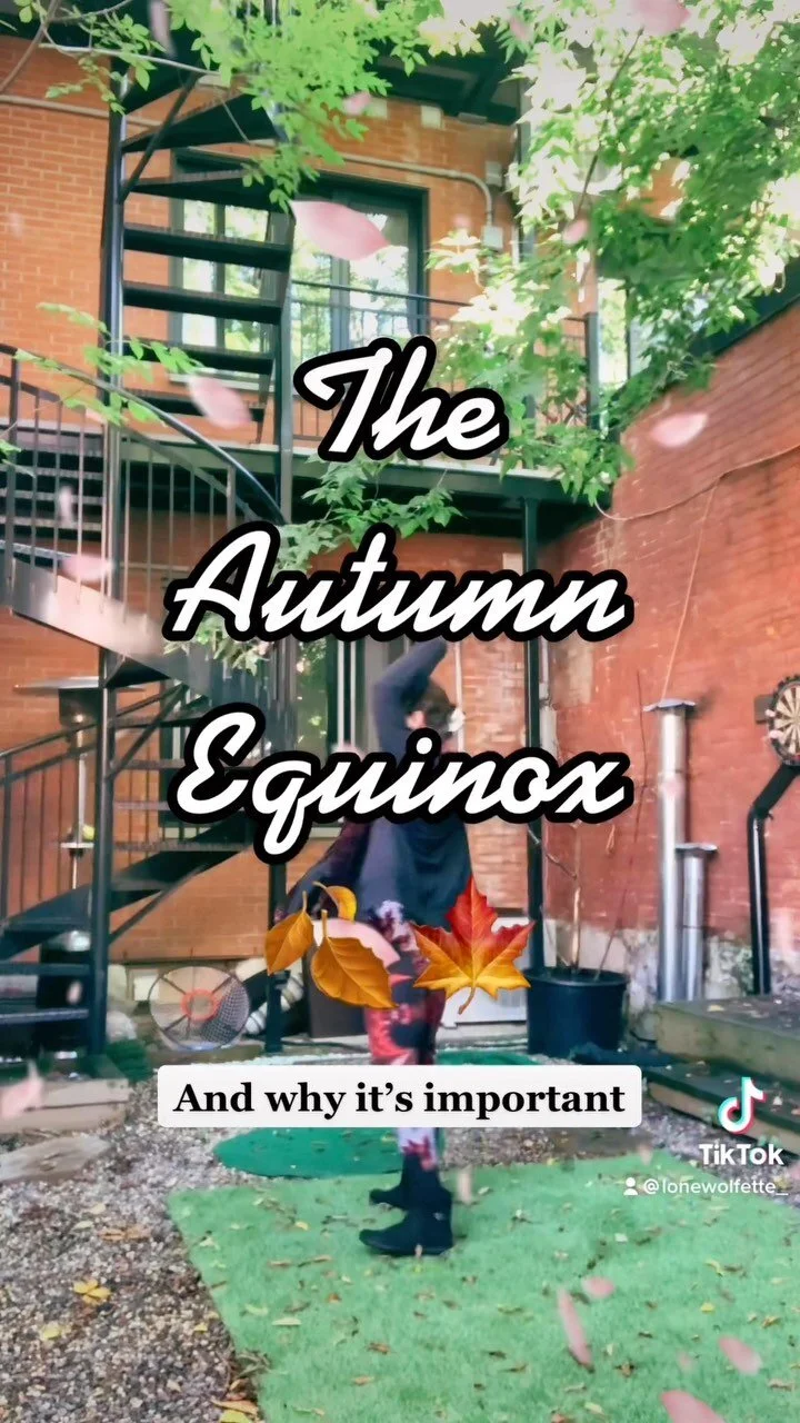


The guide with EVERYTHING you need to plan your trip to the ever-growing coffee region - including full itineraries, which towns to visit, how to get around, what to pack, and more.

The guide with EVERYTHING you need to plan your trip to the ever-growing coffee region - including full itineraries, which towns to visit, how to get around, what to pack, and more.
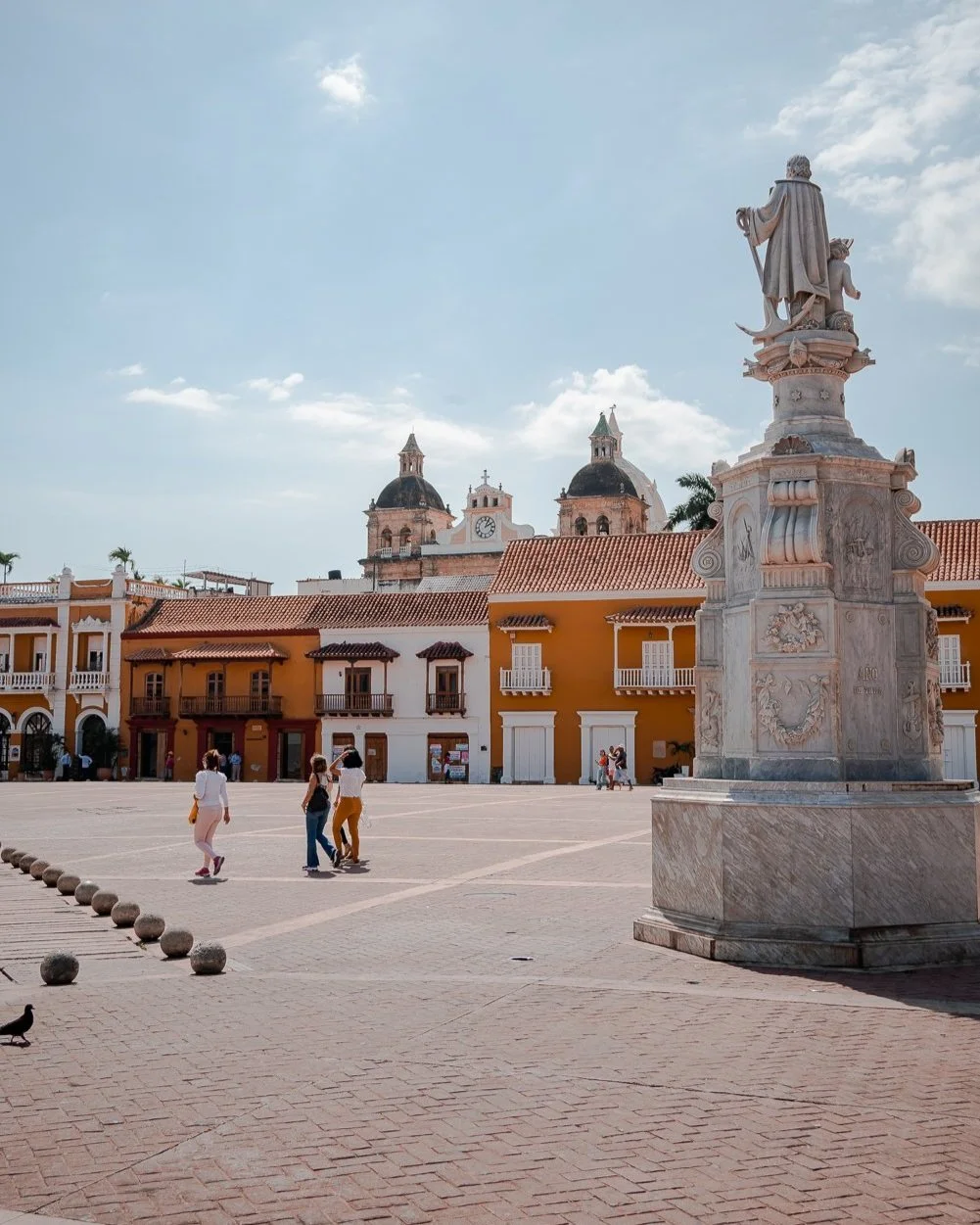
In 3 days, experience the cultural renaissance of Colombia’s vibrant port city, now known as a global destination for its sunshine, art, dance, architecture, and tropical islands.
How many days do you really need in Colombia’s sunny hub? Check out my ideal itinerary, the best things to do, and day trips from Medellin!
Colombia has diverse climates and fashions in each city. So what should I wear in Colombia? This list includes comfort, convenience, and style for all my ladies asking themselves the same question.
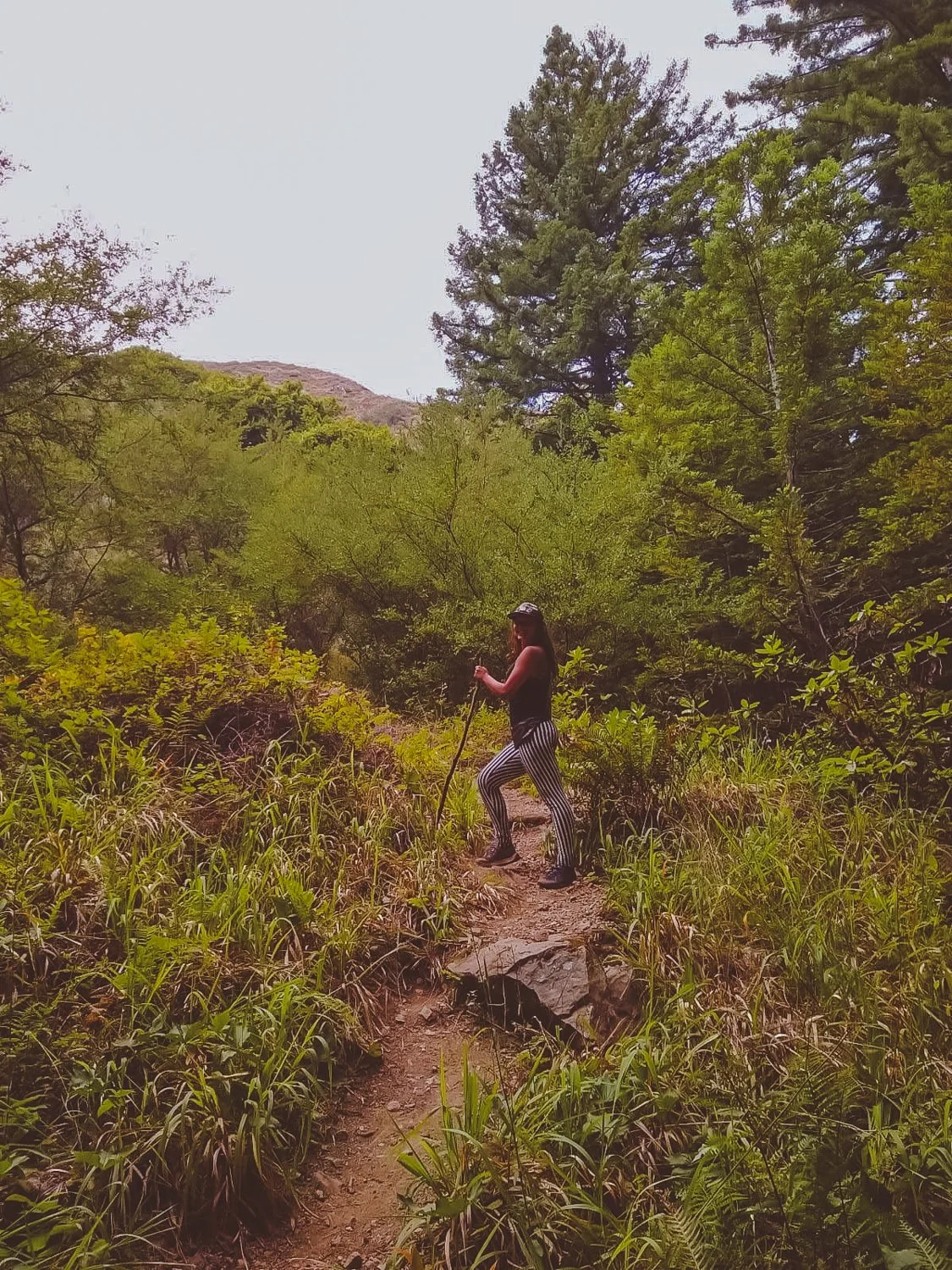
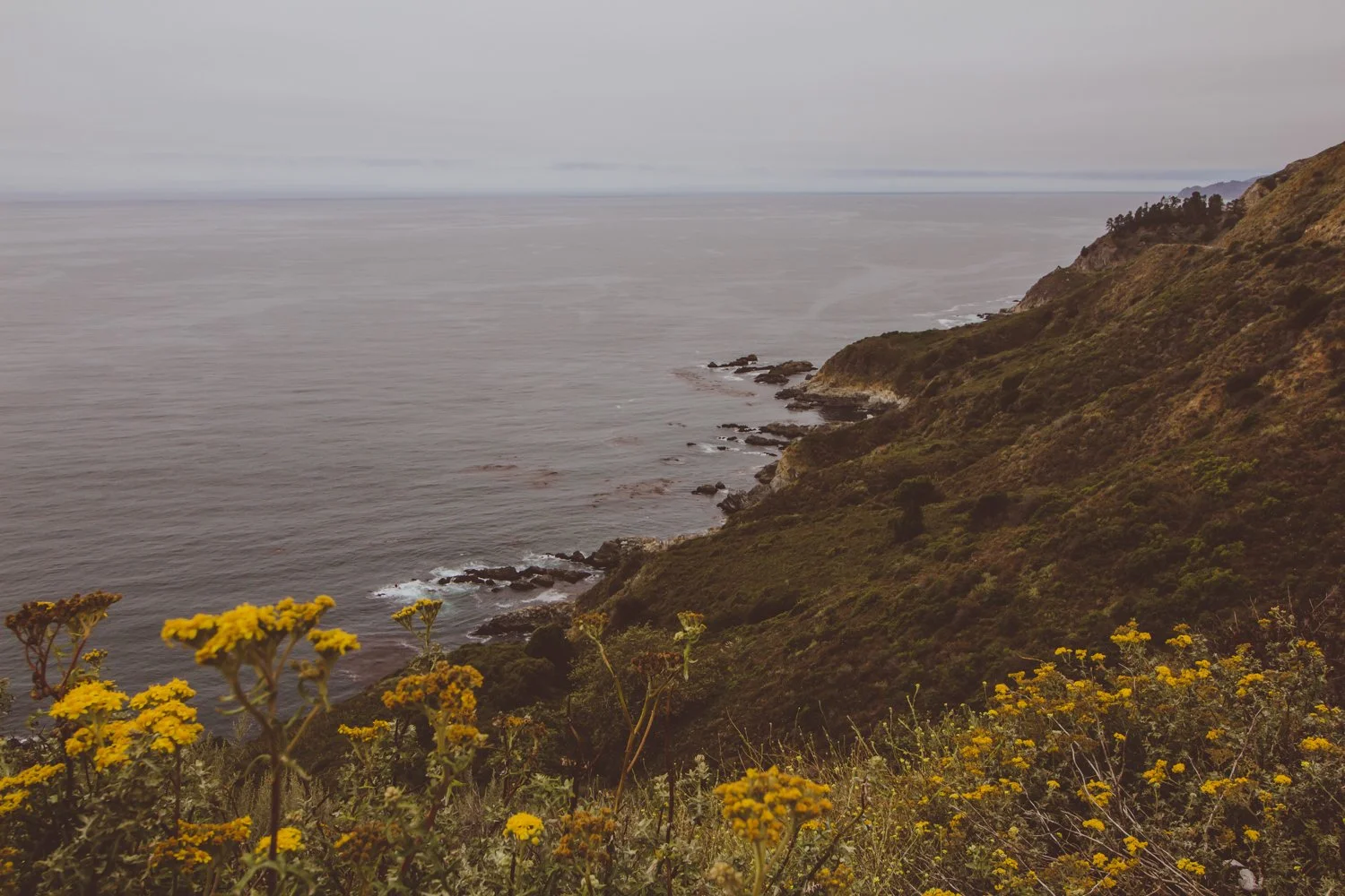
Are you heading on a Big Sur drive soon? Do you love waterfalls, hiking, beaches, wildlife…
…and being out of contact from the rest of the world?
Then read on because I am about to share my secrets with you, fellow budget traveler, with these 11 free things to do along the remote coast of Big Sur, California.
I’m a California native who has driven allll the way up and down our large state (from Mexico to Oregon and back) several times - both on my own and with friends.
I’ve written this article from my own recent experience doing the Big Sur drive post-pandemic with a friend. The untouched beach bluffs that greet you with a different personality every morning remain a photographer’s dream!
Note: Before you hit up these free things to do on your Big Sur drive, you absolutely need to make sure you have maps downloaded offline since the internet will not work at all on this remote coast. You can use the free app maps.me to download the map of California. Make sure you save all these locations beforehand, so you have all the hiking trails and campsite locations. You’ll need them.
Now, get ready to hit the road!

Your Big Sur drive is the place to unplug, get lost, and find your spirit along the unforgiving coastline.
Dark, brooding beaches exist without another pair of footprints in sight.
Purple sand sprawls next to thick sea stars chilling on rocks, while miniature crabs scuttle about.
Sparkling lime waterfalls surprise hikers at the end of miles and miles of overgrown forest trails.
And bushels of poison oak claw at you from every corner.
I spent 5 days with no cell service exploring the longest stretch of undisturbed coast in the United States: Big Sur, California.
90 miles along Pacific Coast Highway 1 in Central California from Carmel to San Simeon brims of rocky beaches with character and redwood mountains so steep they’ll bang up any car smaller than a Jeep.
Upon arrival, it is easy to understand why Big Sur glitters majestic.
For rugged campers or backpackers, the solitude experienced on the Big Sur drive is a dream. You must have an offline map to find your way around the less-visited landscape, while families will probably stick to the state parks.
Besides privacy, the preservation of the area maintains that Big Sur will always stay true; the flora and fauna will (hopefully) continue to flourish, and it gives people a chance to see how beautiful California would be without infrastructure.

Lastly, Big Sur wows due to its affordability. If you are craving a getaway and know how to pitch a tent, you can visit Big Sur for the price of food and gas.
I will note that state parks charge $10 for cars, but there are ways to get in free as well which I will detail below.
Ok Wolfette, here are 11 free things to do on your Big Sur drive in California, from a local:
Location on Google Maps: Elephant Seal Vista Point

Those aren’t rocks… they’re elephant seals laying down!
Our first Southern stop on the way to Big Sur proper was an unexpected turn at the Elephant Seal viewing area in San Simeon.
Don’t let the mellow photo fool you. These elephant seals play-fought in the water together and bounced along the shores until we experienced cuteness overload.
Yes, it’s free like everything else on this list. You’ll just stop on the side of the highway for your up close encounters with wildlife.
Location on Google Maps: Salmon Creek Trailhead
Hiking distance: 0.3 miles

Wow! These gorgeous, green falls at Salmon Creek reside just a short walk from highway 1, so no strenuous hiking is involved.
Keep an eye out as you map your Big Sur drive, because you’ll have to quickly park at the side of the road (no parking lot) on a busy bend of highway.
Wade, swim, and jump in the emerald pool to cool off. If you desire a longer hike, you can continue up the trail to Upper Salmon Creek Falls, about 5 miles round trip.
Location on Google Maps: Ragged Point Inn & Resort
Hiking distance: 0.8 miles
Ragged Point is a steep hike that leads you down the cliff to a gorgeous, quiet sandy beach where you will probably be alone, due to the nature of the trail.
You will park in the same parking lot as Ragged Point Inn & Resort, with the trailhead behind the hotel.
To make the descent safely, you’ll want athletic shoes with traction since the loose dirt tended to slide underneath your feet.
We had fun stomping and jumping around the round rocks at the bottom and finding our own hideaways for about an hour.
Location on Google Maps: Nathaniel Owings Memorial Redwood Grove
Hiking distance: 0.6 miles
We missed the stop at Redwood Gulch, because no sign warned us along the road. After turning around and going back to the coordinates of the unmarked turnoff, we spotted a thin beige path.


This unassuming path led us to the location of the southernmost Redwood trees, lining a watering hole perfect for a skinny dip.
The humble falls and musky forest seemed to be plucked out of a fairytale. (Any 90’s babies remember the cartoon forest nymph, Fern Gully?).
Location on Google Maps: Sand Dollar Beach
Sand Dollar Beach might possibly be our favorite beach in California.
We discovered several spacious caves on the edge of the beach, large enough to walk around in and relax. The caves resembled secret auditoriums, a shaded paradise away from the world while we lazily peered out at the blue horizon.
In addition to private caves, the beauty and adventure lured us in. The water appeared so clear and pristine that you could see each grain of sand beside your toes. The sky reflected off the sand, projecting an infinite sapphire vortex.
To avoid any fees, simply park on the street outside of the parking lot.
Location: Hidden (Details below)

Big Sur’s low-brewing clouds prove eerily reminiscent of a James Bond film, paired with boosted high mountains that call in the heavens.
Although most official campgrounds were listed around $40-$70 per night, you can save the cash and camp for free in several astounding locations throughout Big Sur.
Instead of giving away all the secrets here and exposing the spots, I recommend you use the apps and websites Campendium, Boondocking, or freecampsites.net to check out the updated campsites that other reviewers have listed. These are the tools I always use on my primitive camping journey, along with maps.me.
A lot of these camp spots require a four-wheel drive vehicle to reach them (we learned the hard way) and may be unofficial, but they will usually be free.
Other non-free options include looking on Hipcamp (like Airbnb, but for camping) or camping within the state parks and official campgrounds (Kirk Creek campground has an awesome view!).
Location on Google Maps: Mill Creek Trailhead
Hiking distance: 2.3 miles
Zip down the mile-or-so-long trail to quiet Mill Creek, where you can walk-in camp or just chill by the creek in a forest-flooded daze.
The forest quickly transformed into pages of a storybook: illustrations depicted sleeping wood, golden sunlight peaking through the standing beauties, and viney grottos to soak in.
We plummeted to the bottom of the valley and turned left along the creek, following the water’s way to increase the trail length. Just watch out for poison oak and snakes along the way (and bring warm clothes for after that icy fresh bath, even in Summer.)
Location on Google Maps: Andrew Molera Beach or Pfieffer Beach

Our Big Sur drive displayed a rainbow of colors, from purple sand to green forests, blue skies, and orange Golden poppies.
The rose tinted bluffs, like in the photo above, scatter purple sand along Pfeiffer and Andrew Molera beaches.
You’ll have to visit the beach to find the most concentrated areas, where the sand is literally bright violet.
Location on Google Maps: Big Sur River Gorge
Our beloved sun’s UV rays don’t take the day off even when the weather is overcast, so we sought a brief whisper of shade along the Big Sur River.
The River Gorge forms a swimming hole in crystal clear pools after a mellow trail.
Seeking a remote escape, travelers can receive free hugs from the wildflowers, arbors, and aquatic bodies that live in Big Sur’s state parks.
Winding miles and miles of trails in these state parks each tell their own chapter in Big Sur’s anthology.
While most of the parks are $10 for cars to park, you can instead park on highway 1 and enter them for free on foot (except for Limekiln: no walk-ins).
If you do decide to purchase the $10 parking pass for any of the following parks, the pass is valid for any of the other parks on the same day - essentially free.
Location on Google Maps: Limekiln State Park
Arrive before 10AM to get a parking spot in this southern state park.
Skip over to Limekiln Creek Falls for a dreamy staircase of cascades, and follow along peaceful Hare Creek for a 2 mile nature walk.
Location on Google Maps: Pfeiffer Big Sur State Park
The Pfeiffer Falls and Valley View combination route guided us to a modest-falling spout, though nonetheless enchanting, and a sunny lookout to reward our sweaty backs at the top.
The most well-rounded journey is Buzzard’s Roost trail, a spellbinding path sprinkled with young redwoods, tricky hills, and the Big Sur River welcoming you at the front door.
Location on Google Maps: Julia Pfeiffer Burns State Park
The picturesque McWay Falls graces postcards and magnets as an icon of Big Sur proper.
Besides the falls that tumble onto a scenic, teal beach, the park charms with a secluded silver bay and cliff-hanging trails.
Location on Google Maps: Andrew Molera State Park
Combine the Beaches (easy), Bluffs (moderate), and Ridge (strenuous) trails for a heart-beating 8-mile adventure, or simply pick one to wander along.
If the fog clears out along the Ridge trail, you’ll get a panoramic view of baby blue waters among the fragrant foliage — though you’ll have to climb dozens of flights to earn it.
For a less mobile day, indulge in pure beach access at Molera Point.
Location: Anywhere there’s a turnoff

The Big Sur drive is full of epic views like these, with no one else around…
Sometimes, the most precious pleasures are the freedoms you create yourself.
Roll up a quilt and tuck in sandwiches, muffins and hot coffee. Simmer over to a turnoff on the coastal highway, and enjoy a picnic overlooking one of the last natural places in the world.
hi wolfette, i’m molly
Travel is a spiritual experience for me, especially when adventuring solo.
After visiting 6 continents on my own, I’ve dedicated this project to assisting other Lone Wolfettes on their journeys.
I hope my travel guides help you find the same joy, connection, and empowerment that exploring our planet has given me.
Central California’s Yosemite National Park was the third area to be declared a national park in the United States in 1890, properly preserved for its abundant wildlife and rugged beauty.

Yosemite is famous for its colossal granite mountain faces, frothy waterfalls and enormous Sequoia trees. The park’s serene setting is a magnet for adventurous backpackers making their way up the John Muir Trail, as well as groups visiting from around the world to camp in the Valley and see the main sites.


We visited the park in late October 2020, which had its advantages, but also its drawbacks — both of which I will detail in this article.
Here is a snapshot preview of our trip to Yosemite National Park during COVID times: the pros, the cons, and the best things to do in Fall.

We entered the park at the east entrance near Mammoth Lakes, California at an icy 9,000 feet altitude – a chilly welcome, yet with many advantages.
Right near this entrance lies Aspen Grove – a secluded campground tucked away in the quiet forest.

A rocky creek splashes beside the sites, breaking up the stillness of the cool air. Copper, orange, and rustic red trees are spiced along the stream. Fallen limbs brim the water’s edge where nature has run its course.

The weather temperature dropped below freezing that night, but the soft sunrise that peaked through hard branches was worth the extra frost.

Majestic waters awaited us along Tioga Pass, the scenic stretch of highway through the park that stays open until snow season around November.


We stopped for photo ops of the freshwater beauties, the perfect royal blue backdrops.


I was dressed in so many layers of chunky sweaters and scarves and snowboard pants, right before the sun suddenly sneaks out and surprised us. We even saw other hikers wearing shorts as we unraveled a million layers off our body!


This steep climb will have you ascending around 1000 feet per mile. With crisp mountain air as our fuel, the hike to Cathedral Lakes and back is 8 miles roundtrip, even with the big hill!
Spoiler alert: with a 30-pound “Phatty” the pooch in tow, we never made it to Cathedral Lakes – but mainly because the Autumn sundown creeps in early at 5PM (no worries, Phatty).

The only waterfall that still flows in Autumn is Bridalveil Falls, as all the other cascades have dried up over the summer without rain.
Currently, Bridalveil Falls is currently closed in 2020 for construction (can’t catch a break this year, can we?). However, the falls are still beautiful to glimpse from afar until the trail opens up again.

At the bottom of a lonely canyon lies the Mariposa Grove of Giant Sequoias, a haunted walk of fallen leaves and silent giants.


We stumbled upon an old tree with the insides hollowed out. Though I can be claustrophobic, I can cross off my bucket list that I have crawled through a tree longways like a tunnel.

Be aware, the 2-mile hike back out of the valley grove proves quite steep!
Speaking of trees, what list of Autumn moments would be complete without including jumping in a pile of crunchy orange leaves?!

Honestly, the best thing about visiting Yosemite in Fall is the spectrum of colorful shades. The contrast of dark and light shades in Yosemite’s lakes, peaks and trees is stunning.


The most striking feature of Yosemite National Park is the epic granite domes that tower over visitors in Yosemite Valley.

These chalk-colored monsters were shaped from glaciers that swept over the granite during the ice age, along with erosion, forming huge domes.

Take the trail along Mirror Lake for protruding views of the gargantuan Half Dome, or stop in the valley meadows to look El Capitan in its 3,000-foot face.


With less crowds in the Fall, we often had the trails to ourselves in the late afternoons – besides for the thriving animals and plants, of course.
We danced with hula hoops through private corners and played flute to echo among the trees, listening to the sounds of the forest speaking back to us.


In a nutshell, or an acorn, the best way to spend your time in the park is by carving out your own adventure on the trails less traveled by (with less visitors in Fall) and making the most of the off season (through cold weather and COVID times).
You will find there is always something unique to discover in Yosemite National Park!

Stand on the edge of the Earth, peering down at the crusted layers of core that peel back to reveal a deep canyon of rivers, trees, and multi-colored rock.
Ascend onto deformed shapes resembling goblins, castles, or backbones of a lurking beast.
Question your galactic surroundings as you squeeze through narrow slots of Mars-like walls.
Southern Utah is home to enormous stretches of natural treasures that make for a perfect road trip, all within a few hours driving distance of one another.

While droves of experienced trekkers swarm from around the world to hike Utah’s famous Zion National Park, this Southwest corner of the U.S. houses several other gorgeous Parks deserving of a visit.
If you are frequenting 3 or more national parks this year, you should purchase an annual national parks pass ($80) that gives you access to any national park in the country. For multiple state parks, Southern Utah maintains different passes, available upon arrival.
Following the route of our road trip, here are 6 epic national and state parks we conquered in Southern Utah:

Arches National Park ended up being my favorite park, certainly worth the out-of-the-way excursion to the East side of Utah.
The famous Delicate Arch (featured in the article’s main photo) graces the Utah license plates for a reason. Each naturally-occurring arch in the park stands larger than life when you reach them up close.
Mellow, moderate, and difficult hikes reward visitors with hanging arches and glowing caverns.


We also witnessed petroglyphs throughout the park, finding them prevalent throughout Utah.
I recommend you linger in Arches after dusk, and even camp if you can. The animals meander at night, the people leave, but most of all, the starry experience lights up the silent magic of the park.

On the way to Canyonlands, we took an unexpected stop at Dead Horse Point State Park. The jolting name comes from the abrupt canyon drop-off where stampedes of horsed would unknowingly run over the side.
Thankfully, we didn’t fall down the canyon - but the panoramic views of the Colorado river astounded us.
The level walks around this small park brought relief from the daring adventures at the other parks, but still got us a bit lost, which is always fun.

Canyonlands’ name sounded like a theme park to me - and ultimately, the great heights, treacherous climbs, and hundreds of miles of trails fostered a similar happy-go-lucky experience.
This gargantuan park spans over 330,000 acres of land, with so much to do that I could return again and again. The park is divided into 4 districts: Island in the Sky (most approachable and popular), the Needles (farther hikes for backpackers), the Maze (most remote and inaccessible), and the rivers Green and Colorado.

When you reach the spout at the top of Whale Rock, you have to take a photo, right?
While the stunning Mesa Arch was closed, we stomped up Whale Rock, as well as a full-sun saunter along Murphy Point Trail (note to self: pack a parasol per person next time. Phew!).
In addition to hiking, Canyonlands offers river rafting, jeep tours and other backcountry excursions. You could easily spend a week there exploring.

We screeched to a halt as we passed the sign for Goblin Valley State Park, a name too enticing to pass by.
Mushroom-shaped hoodoos personify little goblins in this trippy valley as you head West through the bottom of the state.
Weather and the elements carved these figures into thick monsters, causing you to wonder if you are on a bad psychedelic trip. You can spend time trying to guess what the hoodoos resemble, as if you were pondering over clouds in the sky.

Be warned, the dry heat lingers warmer down in the valley, where there are no set hiking trails - just wander freely. In late June, we couldn’t stay longer than an hour in the valley while we sweltered, even with full bottles of water.
Pleasantly, we completed the hikes around the valley that highlighted Molly’s Castle (hey, that’s me!) and a surprisingly skinny slot canyon.

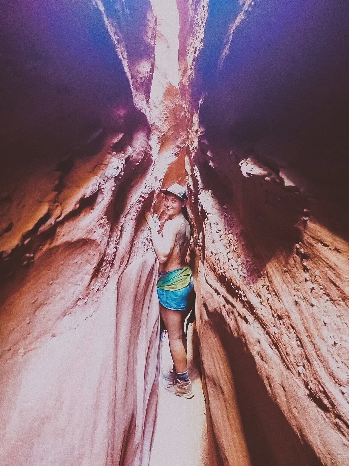
Encompassing over a million acres, we barely scratched the surface at Grand Staircase-Escalante National Monument. The staircase name details the row of plateaus from Bryce Canyon toward the Grand Canyon.
These photos featured are from the Spooky Slot Canyon, a hike so narrow that only smaller folks can squeeze through, without a backpack.
I learned rapidly that Utah hikes were not for the faint of heart, with parts of the hike you could seriously get stuck in (but yes, I still recommend it the challenge!).

The humongous swath of land in Escalante features waterfalls, gulches, slot canyons, and hundreds of miles of towering cliffs. In other words, the remote hiker can really get away from it all at the Grand Staircase, an epic place that deserves much more of my coverage.

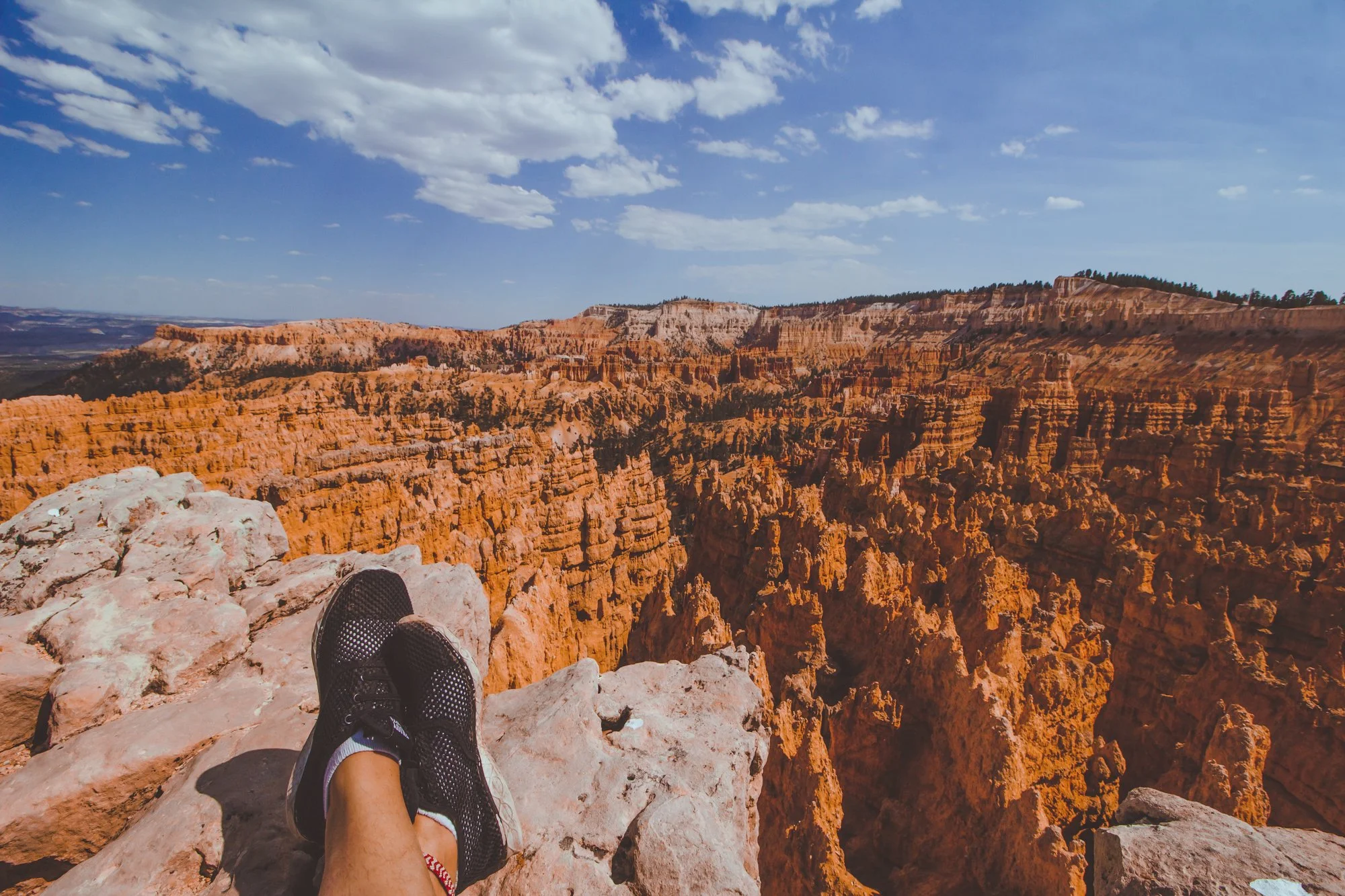
Bryce was so nice, I had to visit it twice! Check out my article on how to spend 1 day in Bryce Canyon for a full synopsis.
The main access road through Bryce Canyon National Park stretches just 18 miles, packing the most punch into a relatively “smaller” park, so you can see a lot of variation in a short amount of time.

Connect Queens Garden with Navajo Loop for a fantastic well-rounded hike that features redwoods, peek-a-boo windows, lavish structures, and a rainbow of whites, oranges, yellows and reds.
The colors of Bryce pop as bright as the pictures, and sunsets shine absolutely golden.
Happy travels!
Rustic red beauty, gargantuan rock formations, and mysterious valleys can keep you trekking through the elusive Bryce Canyon for days.
However, unlike other national parks, this Southern Utah park is fairly compact and is accessible for travelers who only have a day to pass through, often before or after the neighboring Zion National Park.

We were able to take advantage of the nearly 9 PM sunset time in June and discovered the best way to spend one day in Bryce Canyon National Park in the Spring / Summer season. The views were stunning, colors struck a vibrant chord, and the golden hour saturated the skin and sky.
This spontaneous pit stop proved well worth the sunny day visit, though I will have to return again sometime in winter to experience the mystic icicles and snow-topped hoodoos, the eroded rock pillars that Bryce is famously abundant for.
Enjoy my guide on how to spend one day in Bryce Canyon National Park… and you don’t have to wake up at 6 AM to do it. We’re living life on mountain time now, baby!
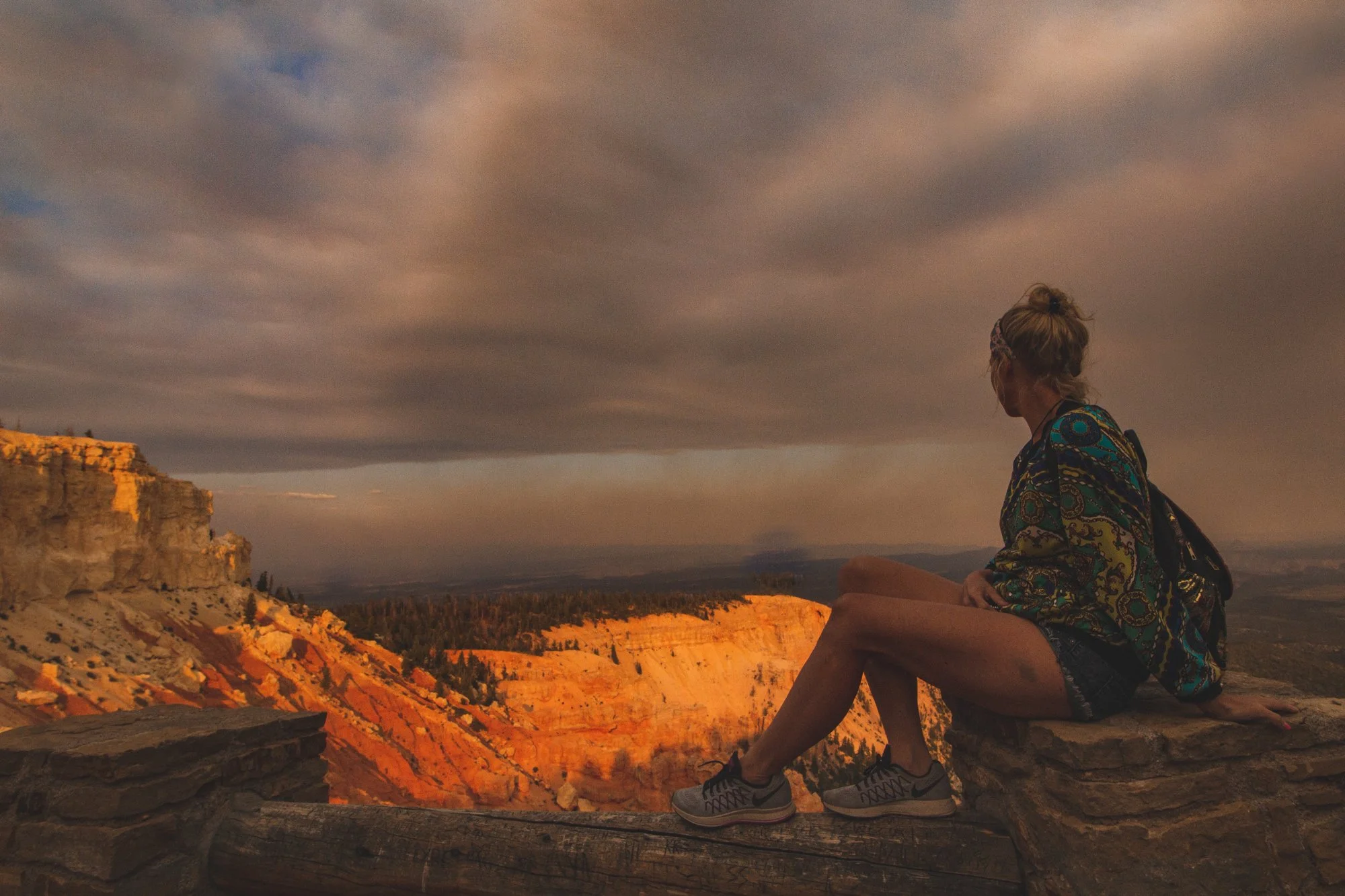
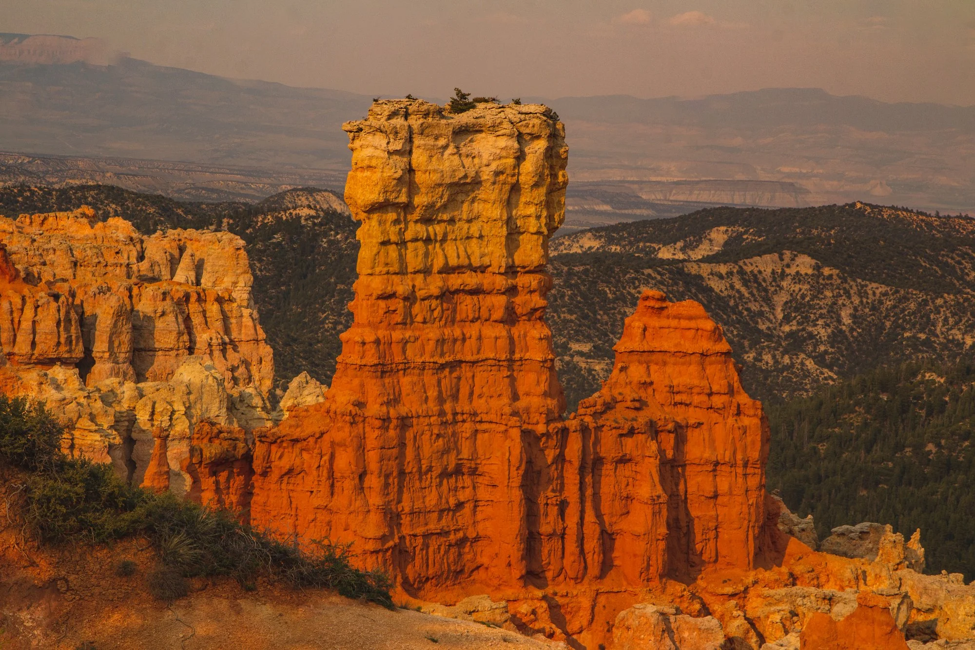
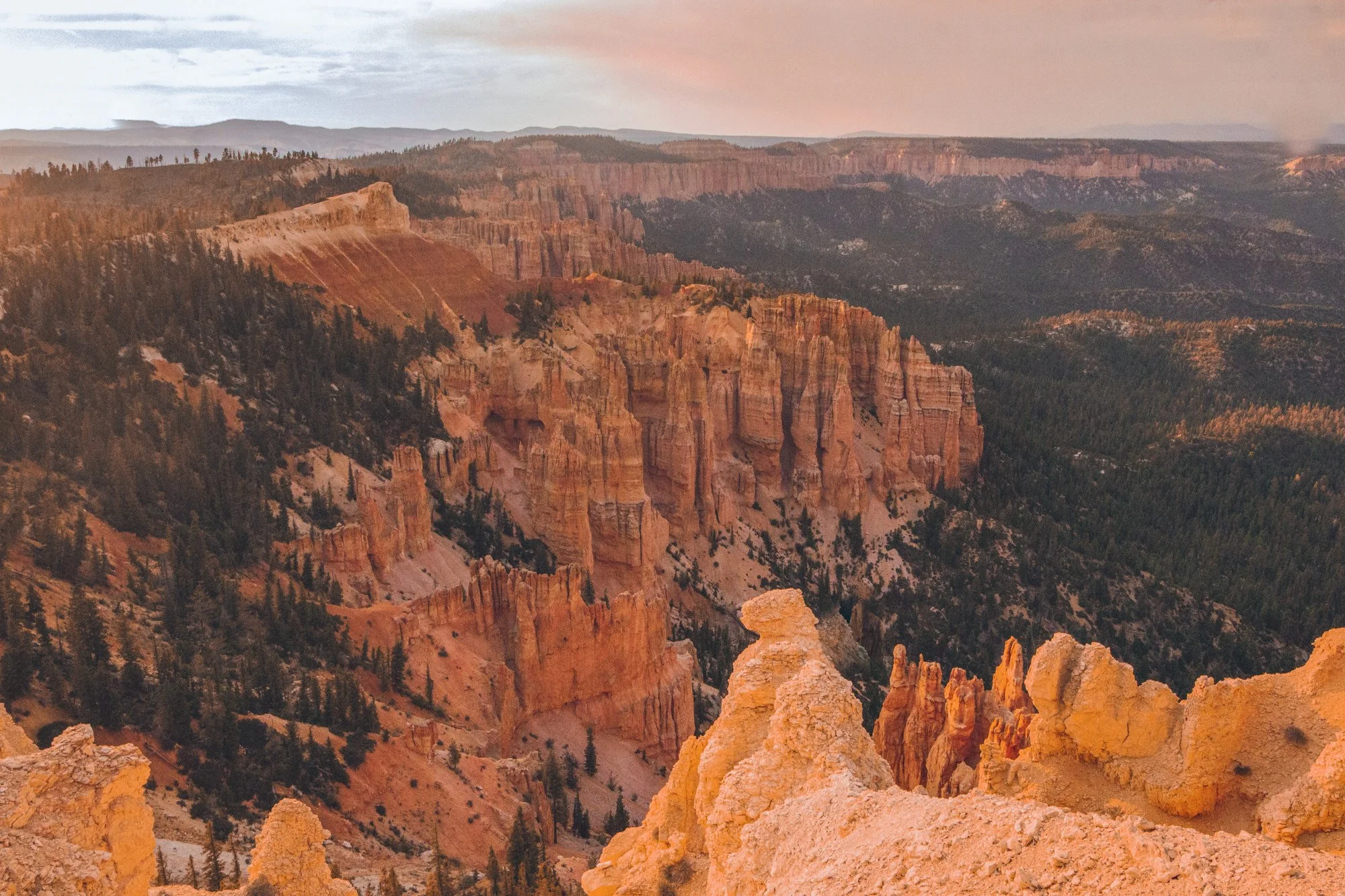
Immediately upon entering the park, you are greeted by Bryce Amphitheater, the orchestral valley with red, orange, and yellow hoodoos stretching as far as the eye can see.
Jump out and stroll along the Sunset to Sunrise trail for one mile of epic photo opportunities along the entire perimeter.
Potentially the most popular trail in Bryce Canyon, this 2.9-mile combination loop welcomes visitors embarking from Sunset Point to witness surreal changes in the earth’s landscape with striking caverns and monstrous structures that possess these distinctive names.

Highway 63 spans 18 miles of stunning viewpoints, the next being Inspiration Point and Bryce Point.
Look for the arches and windows formed by hoodoos that categorize each landscape unique.
Wildlife roams freely through the park, with dozens of species of bird, mammals, reptiles and amphibians. We spied mule deer, blue jays, ravens, lizards, squirrels and luckily, no Great Basin Rattlesnakes. If you are fortunate, you could even encounter porcupines, foxes, or even the endangered California Condor.

While this hike through the quiet backcountry is 4 miles, you can briefly cruise through the tree-lined trail for as long as you desire before turning around, to steal a taste of the terrain.
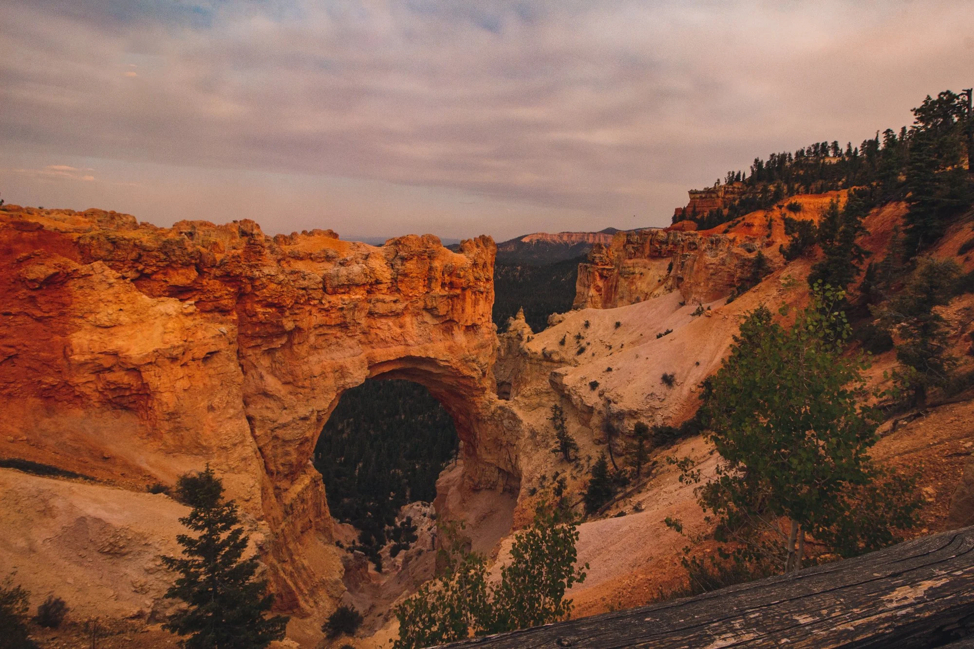
Natural Bridge became my favorite viewpoint of the entire day and features the attention-grabbing arch that steers your eyes into the valley. Agua Canyon is just a half mile down the road and full of imagery reminiscent of Dr. Seuss’ timeless book, Oh, the Places You’ll Go!…
Rainbow Point earns its name from the myriad of colors emitted from its topography: dark green trees mixed with whites, reds, and orange natural amphitheaters.
Our jaws dropped at the panoramic view before we moseyed through the 0.8 mile Bristlecone Loop, a partially shaded walk decorated with fir forests and bristlecone pines, like a winter wonder dream in the Summer.

End your excursion at Yovimpa Point, where the Grand Staircase peeks at you from underneath layers of rock. The Pink Cliffs, Grey Cliffs, and White Cliffs would make this point a more fitting name than Rainbow Point.
hi wolfette, i’m molly
Travel is a spiritual experience for me, especially when adventuring solo.
After visiting 6 continents on my own, I’ve dedicated this project to assisting other Lone Wolfettes on their journeys.
I hope my travel guides help you find the same joy, connection, and empowerment as exploring our planet has given me.
“Molly… How long have you been here?”
My new wide-grinned acquaintance, a 22-year-old shirtless man living in Florida, looked up at me inquisitively as I pranced with my hula hoop on an uneven bamboo dock that was nestled by the sparkling river along the back-acre lawn of Paradise Bar.
“Umm… I don’t know, actually,” I responded carelessly, suddenly realizing I had genuinely lost of track of time during my stop in Pai, the laidback mountain town in northern Thailand near the border of Myanmar. “I think I’ve been here, maybe a couple weeks?”
We were gathered on the outskirts of the main town, enjoying a sun-kissed afternoon by the water with a couple friends, singing classic songs with a guitar-yielding traveler from France and a Brazilian mermaid who carried the voice of an angel. Everything flowed so naturally, and I frolicked my heart out on the dock, feeling deeply connected to the sky, sun, trees, water, and earth like never before. I was barefoot with soil-stained soles, skin tanned to a crisp, unbothered by the mosquitoes and sweat of the 90-degree afternoon.


I suppose I blended in well, feeling so at home with my surroundings, that it appeared I had been in Pai for a long time.
“Have you ever heard of the Pai-hole?” he asked me.
I turned to look at him and paused for a moment, taking a break from flinging my hoop through the soggy air for hours, wiped the sweat off my brow, and exhaled.
“No, I haven’t…” I replied unconvincingly, denying what I suspected what was to come. “What is it?”
Florida was laying down on his back, peering up at the rich purple-colored sky with dazed, half-open eyes.
“The Pai-hole is what you get stuck in,” he explained dauntingly. “It’s when people come to Pai to visit for just a moment, but they end up getting sucked in. Backpackers will travel across the world, spending a few days in each place, hopping all around Southeast Asia, the mountains, the beaches, the islands,” he continued. “But when they come to Pai… well, they forget about all the plans they had, the rest of the trips they were going to make. They never leave.”
Shit, I thought, as I looked around at the overgrown grass, the last of the dusk light seeping into darkness. He’s right. I’ve gone complete, full dirty hippie, singing kumbaya songs to Mother Nature until the wind chill hits at night. I haven’t talked to my folks or friends back home in at least a week. I’ve halted all thoughts of my next buses, trains, or flights to catch, countries to visit. I don’t even wear sunscreen or bug repellant anymore in this jungle village under the scorching South Asian sun. I can’t walk down the streets of Pai without running into handfuls of friends and locals I know, which is always a delight. I spend my nights parading with the circus freaks and dancing to the beat of (literal) drums. I’m living 100% in the present moment, and I absolutely love it.
But I wouldn’t admit it openly yet, the slightest tinge of anxiety creeping in as night fell, thinking about truly getting sucked in to this supposed black hole.
“Nah,” I countered, starting to sway with my hoop again. “That just sounds like something people made up!”
On my right, France suddenly looked up from his guitar, even though he had stopped playing a while ago.
“It’s a real thing,” he stated matter-of-factly. “You’re already in it.”
A few days after that evening, I woke up from my Pai slumber and decided to visit the neighboring area of Mae Hong Son for a new experience, trekking even deeper in the mountains – but I will always remember the beautiful moments shared in this psychedelic village close to my heart.
So what is it about the elusive Pai? What makes this city so compelling? Here are a few reasons why I believe this friendly town draws in droves of backpackers every year, making you never want to leave.

Do you love art, music, dance? Pai has it all. The difference between Pai and other cities, however, is the encouragement of creative expression without any judgment. It’s a great place to get your foot in the door, a chance to try performing in front of an audience for the first time, or to gain experience learning or teaching. This is why Pai fosters a creative hub for aspiring artists to play without hesitation.
Open mic nights offer a space for poets, musicians, and all types of dream-weavers to share their gifts to a supportive crowd. Fire shows and circus acts pop up at different hostels and venues every week. Live jazz, reggae, and acoustic performances are popular staples at restaurants and bars in town. Dance music DJs spin evening sets at open air pubs and the epic jungle parties.
In the related realm of creative spirits, Pai is a flow-centric town with yoga, acro-yoga, and ecstatic dance gatherings for all us new-age backpackers. And as I’ve mentioned before - if you’ve never even tried it, this is the perfect place to start!
Being a relatively small town, with the main roads being Walking Street and Bar street, you get the opportunity to run into the same people everywhere you go, even after just a couple days of visiting.
More importantly, the chill atmosphere between locals and foreigners is more inviting and welcoming compared with the disparity in Southern Thailand as many travelers have noted.
When it’s easy to make friends, you feel at home – even across the world. I also stayed in several different hostels which allowed me to meet more and more people.
Unfortunately for me and others staying in town for extended periods, I would get very close to new friends and then they would leave for other places, resulting in heartbreak every 3 days! But they all sheepishly said the same thing: “I wish I was staying longer.”

Beyond the dreadlocked backpackers and vegged-out nomads, Pai emits psychedelic vibes in its own light, not just because of the visitors! Though it’s not the same “as it used to be years ago,” as the nature of change usually is, it’s still totally a place to trip out and take a breath. Chill.
Whether it’s lounging at a neon hidden hideout like Spirit Bar, whispering under the stars at Pai Yard Guesthouse, dusting in the depths of the Jungle Zone bashes, sitting in silence under the protection of the looming White Buddha, or gazing out into the orange-hilled sunset at Pai Canyon… there is a mystifying presence in the smokey air that you can’t quite put your finger on.

Several waterfalls rush through the corners of Pai, donating a generous dose of pools to cool off in the heat. Hiking trails overgrown with exotic plants hug your limbs as you trek through the misty jungle. The painted sunsets are unmatched over gentle mountains and aggressive rivers. Cold, eerie caves with frosted formations are an hour’s drive away. Reptiles, birds, ox, livestock and all types of insects make their home where they wish – not to mention the elephants at Elephant Camp!
While Pai has practically all the modern amenities one could wish for, it remains a gem for nature seekers who want the best of both worlds.

Unlike other busy night markets in Asia, Pai’s Night Market is a relaxing stroll every night. It’s a social hotspot where everyone meets up without even having to text, gulps a drink in the streets, pries for unique clothes, handicrafts, and of course, eats dinner every night!
Indulge in avocado tea leaf salad, grilled salted-and-buttered corn, savory steamed dumplings, sweet potato and pumpkin burgers, too-big-to-bite falafel pita wraps, fresh fruit smoothies, Thai-style tacos, quirky flavors of bruschetta or flatbreads, chewy banana-nutella crepes or ‘roti’… and these are only the vegetarian options.
Ok, so maybe the globalization is getting a bit out of hand here. But the prices are unbeatable (about $1 to $4 USD per dish for the street vendors), and it’s a tempting break from eating pad thai and fried rice for every other meal.

Staying in Pai is like reading a book: the more you read, the more into it you get. That’s because a lot of the magic is only spread through word of mouth and therefore cannot be found from doing research online or in books. I suppose some secrets are best to be kept.
What treasures, you might ask? I bet I barely know a handful, compared with those who live there, but to give you a taste… A sauna attached to a dance venue. Infinity pools stretching over the mountains. Psychedelic mushroom shakes and farms. Spontaneous drum circles. Bamboo tattoo boys. River-dwelling reiki masters. Shamans, medicinal herbalists. Friendly Thai mothers who invite you into their guesthouses for warm eats and sleeps, treating you more like family than a hotel guest. Fat, furry dogs and cats brushing past your calves at every establishment. Mind-blowing painters and woodworkers. Outdoor wine bars with vocalists belting their souls out into the forest. Peculiar postcard shops adorned with lovely murals and emotional quotes. A new tribe of friends from every continent. (Ok, maybe not Antarctica). And again, blacklight jungle parties, where you have to cross rivers and secret pathways to get there!
But we can’t give up alllll the secrets. You’ll have to see for yourself what the love is all about.
Just don’t get stuck in the Pai-hole.
The best moments can’t truly be captured, right?