


The guide with EVERYTHING you need to plan your trip to the ever-growing coffee region - including full itineraries, which towns to visit, how to get around, what to pack, and more.

The guide with EVERYTHING you need to plan your trip to the ever-growing coffee region - including full itineraries, which towns to visit, how to get around, what to pack, and more.
In 3 days, experience the cultural renaissance of Colombia’s vibrant port city, now known as a global destination for its sunshine, art, dance, architecture, and tropical islands.
How many days do you really need in Colombia’s sunny hub? Check out my ideal itinerary, the best things to do, and day trips from Medellin!
Colombia has diverse climates and fashions in each city. So what should I wear in Colombia? This list includes comfort, convenience, and style for all my ladies asking themselves the same question.
Excited about your visit to Sedona, Arizona but not sure how much time you need for all the adventurous hikes, which parks to visit, and what activities are worth doing?
I am going to share with you the absolutely perfect Sedona 3 day itinerary that includes the best of this southwest destination’s top highlights: red rocks, natural waters, and energy vortexes.

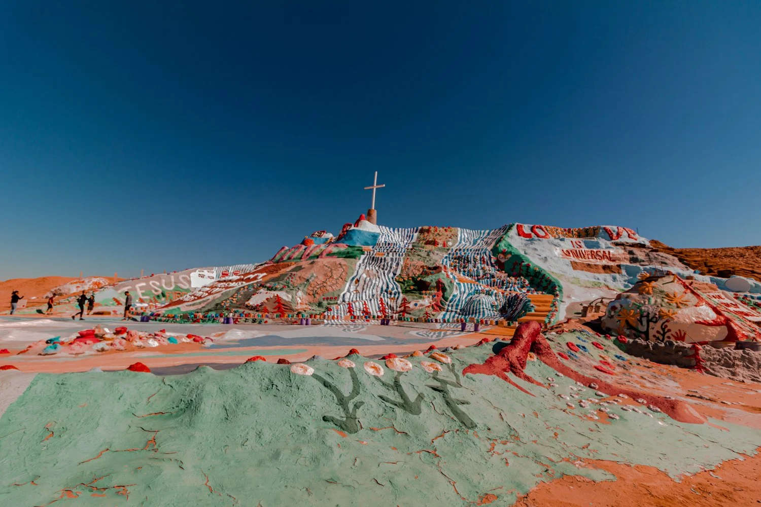
Grateful for the energy this magical, rustic, vibrant place has given me.
An oasis for hikers, Sedona lures in travelers who stay anywhere from 2 days to weeks, calling them in to wander new crevices and caves.
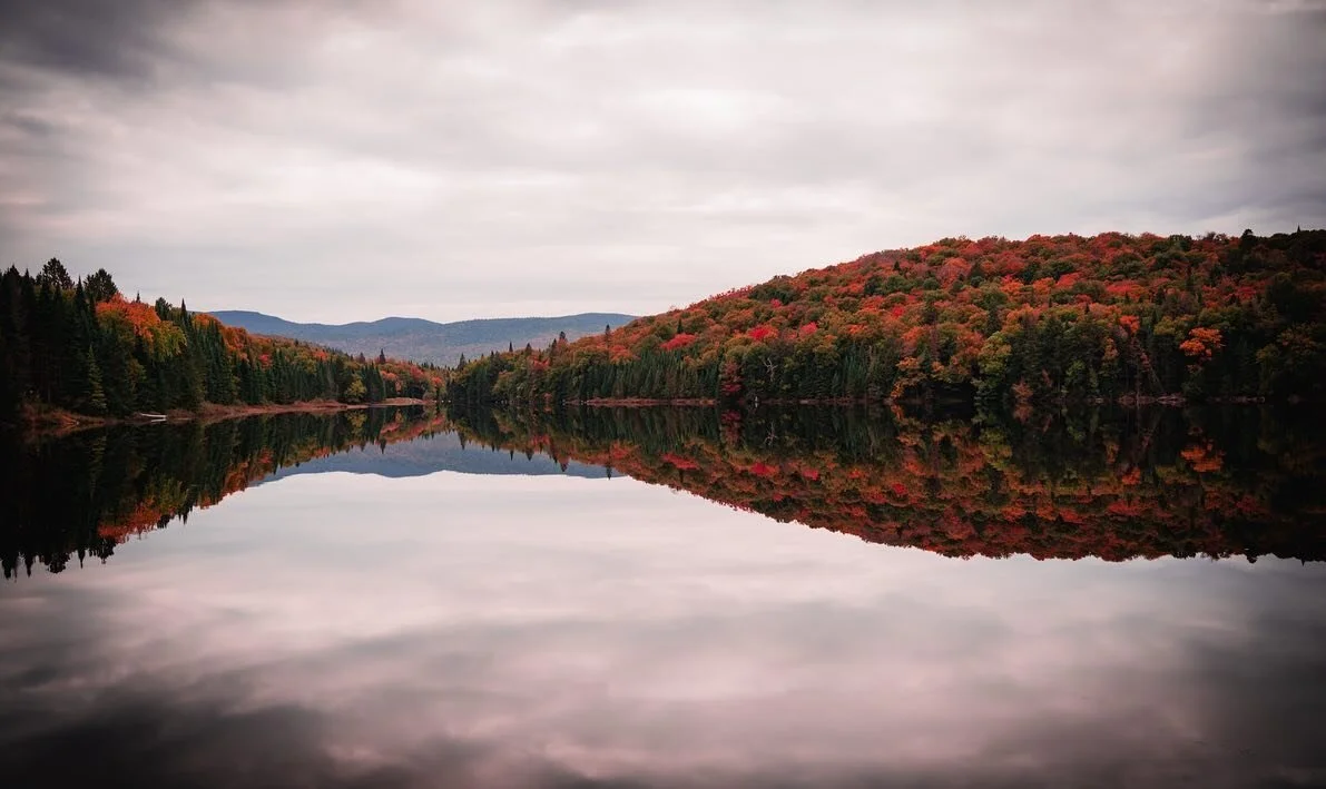
When I visited this green, red, and orange destination in the Fall for my birthday (October 3 - Libra baby!), I found that 3 days was the perfect amount of time to experience most of the mystic area.
If you have an extra day, I’ve included a bonus day 4 to visit the magnificent Grand Canyon, as it is only 2 hours away from Sedona.
Oh, and the friends I road tripped with are late sleepers (despite my wanting to get up early for heatwave hikes)… so if you want to take things slow, just know that this itinerary leaves you plenty of time to relax as well.

I’ll try not to give all the secrets away… just remember to keep the wilderness wild.
But, wait a minute.
What the heck is an energy vortex?
New age folks claim that these vortexes are specific points on the earth that emit strong energy and inspiration from underneath the red rock. There are four centers in Sedona that are thought to host energy vortexes: Bell Rock, Airport Mesa, Cathedral Rock, and Boynton Canyon.
Intrigued by the concept, yet skeptical of anything other than first-hand experience, we crafted a plan to find out. We would visit Sedona and enjoy the world-famous landscapes, whether these spiritual energy centers were real or not.
Additionally, one of the best things we did when planning was to include bodies of water in our itinerary to cool off from the heat after camping and trekking (and sweating) all day.
As a result, our blend of hikes, vortex views, and aquatic time created a perfectly balanced 3 days in Sedona.

Cooling off in the afternoon swimming holes is essential after a hot hike.
Cost: Midrange / Budget
Traveler Type: Any (Solo, couples, groups)
Days: 3 (plus option for a bonus day)
Interests: nature, hiking, mysticism
Transportation: car, walking

Your perfect Sedona 3 day itinerary begins on one of the most beautiful highways in the Southwest United States. (Scenic Byway 179).
Driving from California took us half a day, so we’ll call this Day 1. It’s best to arrive during daylight to soak in the stunning sights of Sedona’s scenic byway 179, so plan your road trip (or flight to Phoenix) accordingly.
You will pass the famous Chapel of the Holy Cross embedded in stone mountains as you head up north, so keep a look out!
Before you get to your first destination, there are a couple of things you should know.
First, most trails require a Red Rock parking pass for your car, which you can purchase at the visitor center or at most parking lots for $5 a day or $15 for the week.

The parking lot of Bell Rock Canyon was pretty empty in the sunny afternoon, even on a weekend.
Secondly, the least crowded time of day to hike surprisingly proved to be the afternoon. For once, sleeping in benefited us! By getting a slower start to the day, we avoided the swarms of morning folks on the trails. Additionally, by hiking in the afternoon we got to relish in the shade and sunsets, so the weather never grew overwhelmingly hot.
Lastly, before you hike anywhere, you should download the offline map of Sedona on maps.me. With no service on the trails, you don’t want to get lost in the heat, and it will help you navigate regardless. In this climate, bring more water than you think you will need and pack a hat, sunglasses, and sunscreen.
Distance: 4 miles
Location & Map: View on AllTrails
Welcome to your first vortex!


After a long drive makes you want to just jump out of the car and move around already, Bell Rock is the perfect hike to launch your hot, flaming rocket of an unforgettable desert trip.
Besides being claimed as an energy vortex, Bell Rock gives a stellar introduction to Sedona’s landscape. As you emerge from the highway, Bell Rock enchants the newly arrived explorer with vast previews of Eastern Sedona.
Climbing the looming face of the gargantuan rock stretches the views wider and wider, and you shrink smaller and smaller.
We reached Bell Rock via Big Park Loop, or you can take Courthouse Butte Loop trail, both ending up being 4 miles. However, the trails tapered off and became difficult to follow once you reach Bell Rock, so all the better to just carve your own way.
Both of these trails welcome all skill levels, remaining generally flat until the mountainous meet-and-greet.
So, did I feel the energy vortex?

Bell Rock is known by some to be an epicenter of strong vibrations and healing energy.
The ridiculous height of the red rock towering over us chilled my spine enough to make the baby hairs on my arm bubble up. And the higher you get, the quieter the air becomes. Mountain silence as we stand on top of the earth.
Yes, it could have just been the breeze of the five o clock purple sky that grazed my soul shield, rather than an energy source. It’s difficult to separate the hefty pulse of excitement from what the “zonies” call a natural resource.
Cave Springs Campground fills up quickly, so snag a reservation if you ever see one available!
Located a few miles north of downtown Sedona in Oak Creek Canyon, Cave Springs delights campers with a swimming hole, shaded forest ceilings, and much cooler temperatures than Sedona proper.

Happy to be in the shade at Cave Springs Campground.
We picked this campground for several reasons. First, it’s beautiful. Secondly, you can refresh in the water from the camp-side creek from the hiking trail that leads to different swimming areas.
Thirdly, when you wake up in the morning, you'll be super close to a wet attraction: Slides!
Location on Google Maps: https://g.page/slide-rock-state-park?share
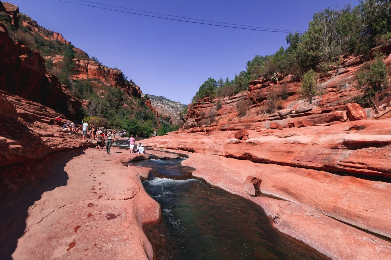
This water was almost freezing cold in Fall but so worth it and refreshing once you jumped in.
Slide down a natural water slide carved into the earth’s wavy crest at Slide Rock State Park!
Exuberant tourists and locals cheered each other on as we each took turns sliding down the bumpy ride.
The dramatic turns seemed a bit questionable at first but somehow safe overall (though I wouldn’t bring a baby on it).
Be warned, however - the ‘slide’ water flows freezing! Well, not completely freezing, but the temperature remains between 40 to 50 degrees Fahrenheit, depending on the time of year.
Besides swimming, jumping off ten foot rocks into the ice bath, and zooming down that erratic slide, you can also hike trails in the park and absorb historical markers.
Next time, I would visit Slide Rock State Park in the Spring instead of the Fall, when the water is full of rainwater, in order to facilitate a smoother glide down that slide.
Distance: 4 miles
Location & Map: View on AllTrails
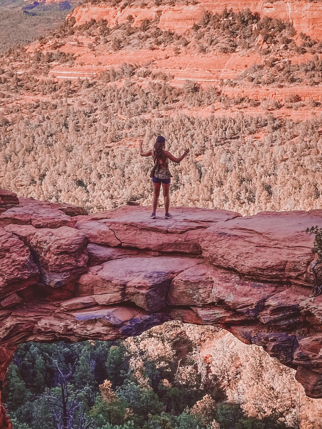
The ominous drop at Devil’s Bridge actually inspired my entire Sedona trip. Though I fear heights, the thrill of walking over that natural arch lured me in like a devil’s hand.
The 4-mile roundtrip hike gradually inclines at a steady pace, making Devil’s Bridge another approachable hike for almost anyone with sturdy shoes.
Sunset invited plenty of photo-philes like myself to line up for that Instagram-ready shot, but the wait was well worth it for the epic view.
Watch your step…


Sedona is a crossroads for travelers wandering through the southwest, resulting in a diverse offering of culinary bites and zen vendors, with a little upscale hipster flair.
In town, we found delectable eateries offer a range of cuisines from Tex Mex to fine dining steak and tapas establishments, as well as vegan varieties (after all, we are in hippie haven).
We tasted the town’s personality with a delicious dinner at Creekside American Bistro. I highly recommend their ahi tuna nachos and vegan bento box… as you can tell from my expression in the photos!

While waiting for a table, we graced the crystal shops and art galleries that sparkle along the plazas and shopping villages. Where else can you stand inside a human-sized singing bowl?


Distance: 1.2 miles
Location & Map: View on AllTrails
Welcome to your second vortex. Ready for a challenge?


Cathedral Rock raised my fear of heights to another level! Luckily, I survived the steep incline that ascends 700 feet in just about half a mile. Essentially, you are climbing in some parts.
Cathedral Rock’s energy vortex is located at the peak. Again, with all the people around it was hard to discern if my senses tingled from the adrenaline rush or a higher power, but it certainly felt like we were at the top of the heavens up there.
Location on Google Maps: https://goo.gl/maps/8jRv8bi3RwCkAJjN9


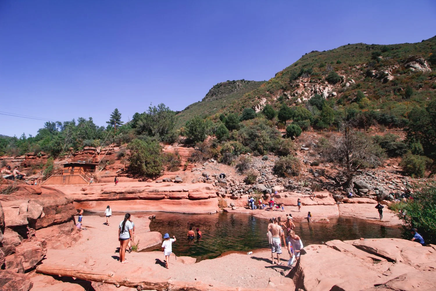
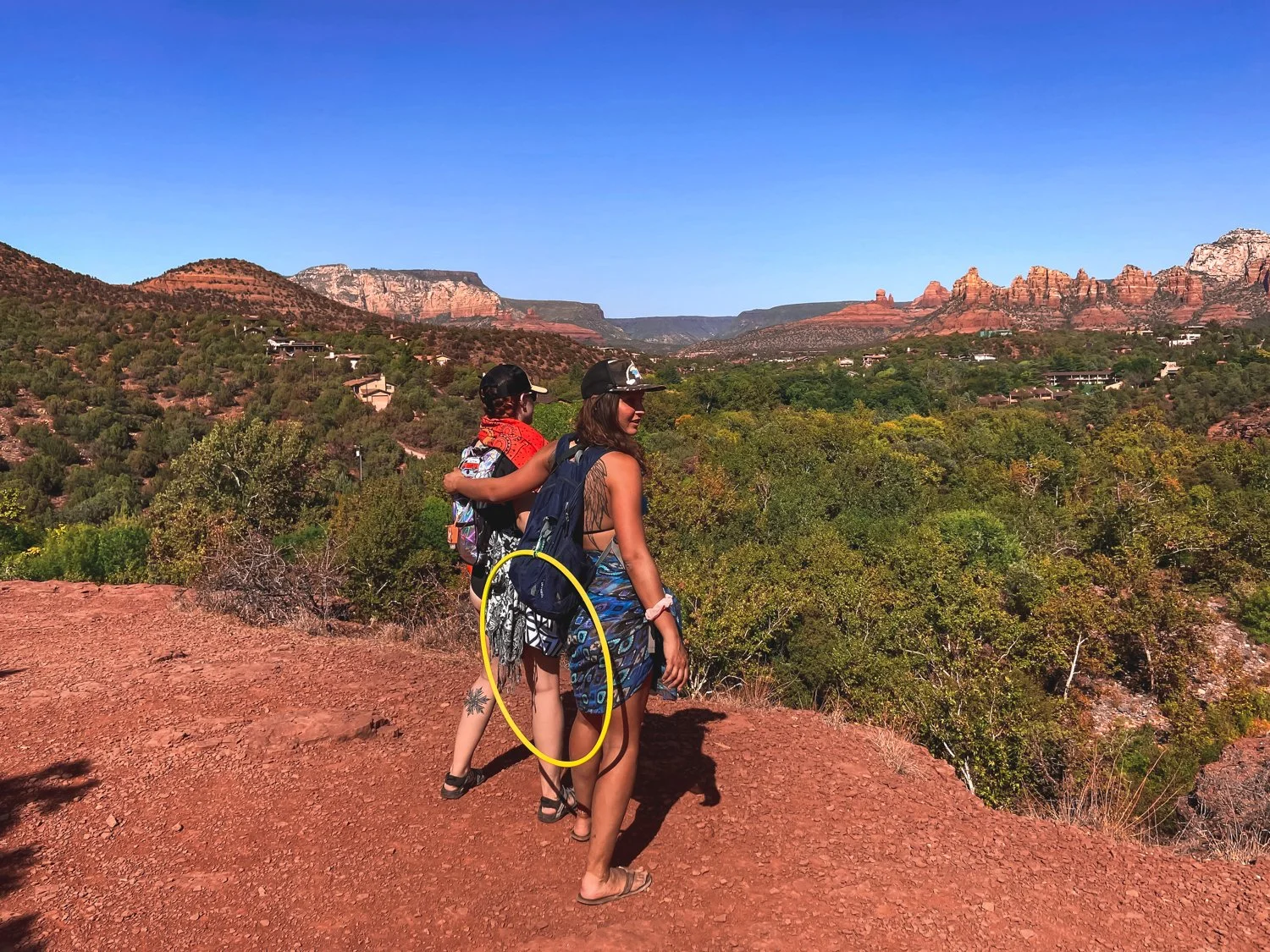
Looking for a place to cool off in the heat, we spent the rest of the afternoon at Grasshopper Point Swimming & Picnic Area, with red rock formations and shallow cool waters.
Luckily we found a spot in the small parking lot, so be prepared. As a second option, I would also like to try the Seven Sacred Pools hike which features caves and swimming as well.
Although splashing, hula hooping, and hiking back up the rocky trail left us winded, we still left time to enjoy the green horizon views with a grin.
Surprise! You’re driving to the Grand Canyon on night 3.
With Grand Canyon National Park residing a mere two hours away, we included a day to hike the famous world wonder.
The drive took less than 2 hours. We stayed at Grand Canyon Inn & Motel in Grand Canyon Junction so that we would wake up just 20 minutes from the national park. It was a safe, clean and most affordable option in the area.
If you have time to swing it, Sedona’s close proximity to the Grand Canyon makes the trip well worth the visit, even for folks like myself who have been several times before.
The Grand Canyon’s enormous route of trails tempts me to visit again and again (preferably not in the summer months, however).
We scuttled down the South Kaibab trail, taking one mile to reach Ooh Aah Point, one mile more to Cedar Ridge, and one mile to Skeleton Point, where unprepared hikers keel over from the treacherous altitude.
Obviously, going three miles down is always easier than stomping the three miles back up a furnace (I mean, canyon), so definitely be wary of your start time.
Sad but satisfied, that marks the end of the perfect Sedona 3 day itinerary in red rock country, plus a bonus day at the mother of all canyons.
As far as the spiritual energy, I concluded that I don’t need to visit a vortex to feel the ecstasy that excites my soul when camping and hiking. It powers my bones alone.
Stay safe, cool, and hydrated, and enjoy your spiritual travel.
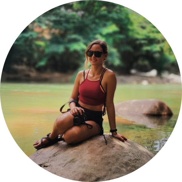
hi wolfette, i’m molly
Travel is a spiritual experience for me, especially when adventuring solo.
After visiting 6 continents on my own, I’ve dedicated this project to assisting other Lone Wolfettes on their journeys.
I hope my travel guides help you find the same joy, connection, and empowerment that exploring our planet has given me.
Stand on the edge of the Earth, peering down at the crusted layers of core that peel back to reveal a deep canyon of rivers, trees, and multi-colored rock.
Ascend onto deformed shapes resembling goblins, castles, or backbones of a lurking beast.
Question your galactic surroundings as you squeeze through narrow slots of Mars-like walls.
Southern Utah is home to enormous stretches of natural treasures that make for a perfect road trip, all within a few hours driving distance of one another.

While droves of experienced trekkers swarm from around the world to hike Utah’s famous Zion National Park, this Southwest corner of the U.S. houses several other gorgeous Parks deserving of a visit.
If you are frequenting 3 or more national parks this year, you should purchase an annual national parks pass ($80) that gives you access to any national park in the country. For multiple state parks, Southern Utah maintains different passes, available upon arrival.
Following the route of our road trip, here are 6 epic national and state parks we conquered in Southern Utah:

Arches National Park ended up being my favorite park, certainly worth the out-of-the-way excursion to the East side of Utah.
The famous Delicate Arch (featured in the article’s main photo) graces the Utah license plates for a reason. Each naturally-occurring arch in the park stands larger than life when you reach them up close.
Mellow, moderate, and difficult hikes reward visitors with hanging arches and glowing caverns.


We also witnessed petroglyphs throughout the park, finding them prevalent throughout Utah.
I recommend you linger in Arches after dusk, and even camp if you can. The animals meander at night, the people leave, but most of all, the starry experience lights up the silent magic of the park.

On the way to Canyonlands, we took an unexpected stop at Dead Horse Point State Park. The jolting name comes from the abrupt canyon drop-off where stampedes of horsed would unknowingly run over the side.
Thankfully, we didn’t fall down the canyon - but the panoramic views of the Colorado river astounded us.
The level walks around this small park brought relief from the daring adventures at the other parks, but still got us a bit lost, which is always fun.

Canyonlands’ name sounded like a theme park to me - and ultimately, the great heights, treacherous climbs, and hundreds of miles of trails fostered a similar happy-go-lucky experience.
This gargantuan park spans over 330,000 acres of land, with so much to do that I could return again and again. The park is divided into 4 districts: Island in the Sky (most approachable and popular), the Needles (farther hikes for backpackers), the Maze (most remote and inaccessible), and the rivers Green and Colorado.

When you reach the spout at the top of Whale Rock, you have to take a photo, right?
While the stunning Mesa Arch was closed, we stomped up Whale Rock, as well as a full-sun saunter along Murphy Point Trail (note to self: pack a parasol per person next time. Phew!).
In addition to hiking, Canyonlands offers river rafting, jeep tours and other backcountry excursions. You could easily spend a week there exploring.

We screeched to a halt as we passed the sign for Goblin Valley State Park, a name too enticing to pass by.
Mushroom-shaped hoodoos personify little goblins in this trippy valley as you head West through the bottom of the state.
Weather and the elements carved these figures into thick monsters, causing you to wonder if you are on a bad psychedelic trip. You can spend time trying to guess what the hoodoos resemble, as if you were pondering over clouds in the sky.

Be warned, the dry heat lingers warmer down in the valley, where there are no set hiking trails - just wander freely. In late June, we couldn’t stay longer than an hour in the valley while we sweltered, even with full bottles of water.
Pleasantly, we completed the hikes around the valley that highlighted Molly’s Castle (hey, that’s me!) and a surprisingly skinny slot canyon.

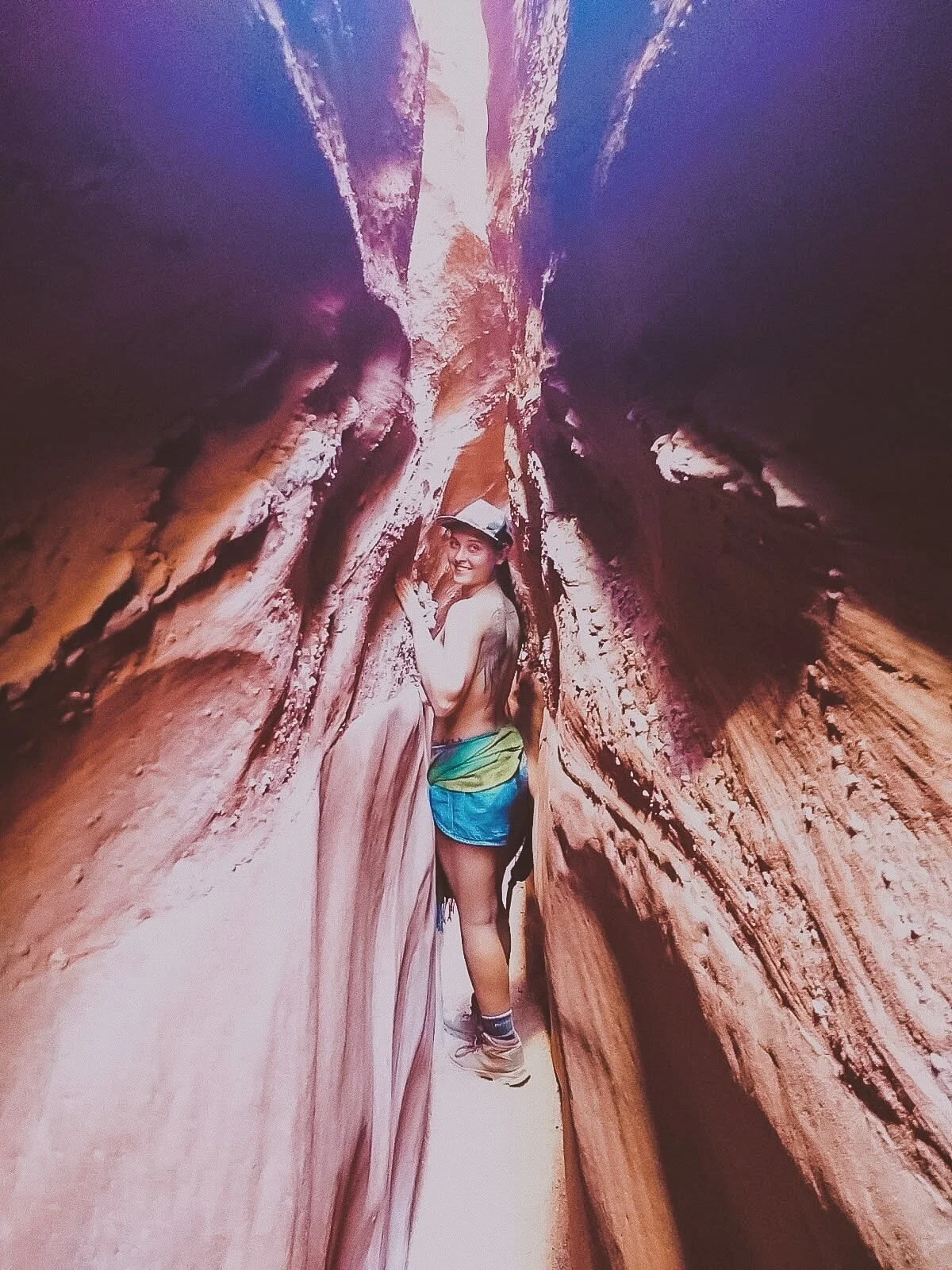
Encompassing over a million acres, we barely scratched the surface at Grand Staircase-Escalante National Monument. The staircase name details the row of plateaus from Bryce Canyon toward the Grand Canyon.
These photos featured are from the Spooky Slot Canyon, a hike so narrow that only smaller folks can squeeze through, without a backpack.
I learned rapidly that Utah hikes were not for the faint of heart, with parts of the hike you could seriously get stuck in (but yes, I still recommend it the challenge!).

The humongous swath of land in Escalante features waterfalls, gulches, slot canyons, and hundreds of miles of towering cliffs. In other words, the remote hiker can really get away from it all at the Grand Staircase, an epic place that deserves much more of my coverage.

Bryce was so nice, I had to visit it twice! Check out my article on how to spend 1 day in Bryce Canyon for a full synopsis.
The main access road through Bryce Canyon National Park stretches just 18 miles, packing the most punch into a relatively “smaller” park, so you can see a lot of variation in a short amount of time.

Connect Queens Garden with Navajo Loop for a fantastic well-rounded hike that features redwoods, peek-a-boo windows, lavish structures, and a rainbow of whites, oranges, yellows and reds.
The colors of Bryce pop as bright as the pictures, and sunsets shine absolutely golden.
Happy travels!
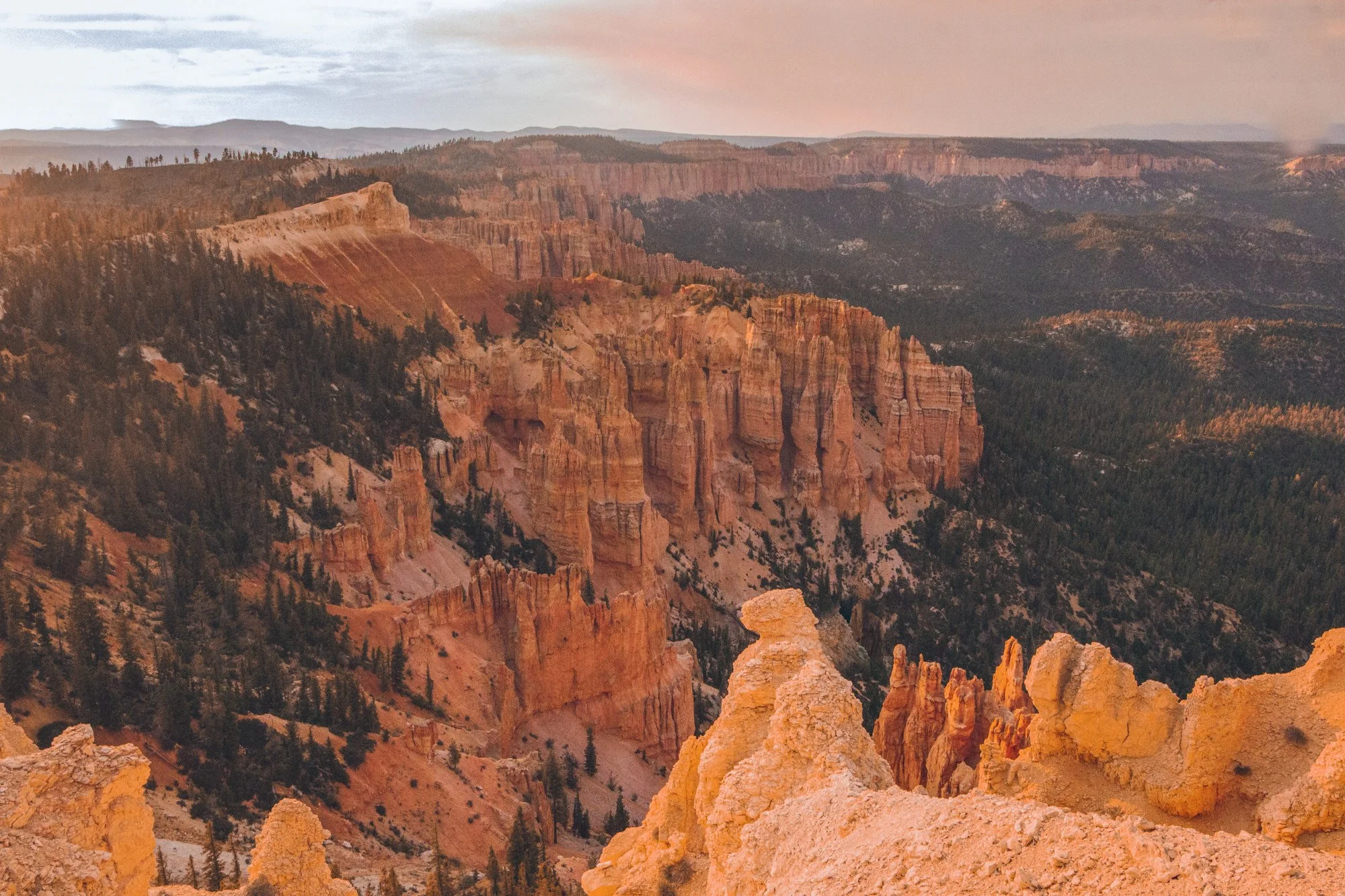
Rustic red beauty, gargantuan rock formations, and mysterious valleys can keep you trekking through the elusive Bryce Canyon for days.
However, unlike other national parks, this Southern Utah park is fairly compact and is accessible for travelers who only have a day to pass through, often before or after the neighboring Zion National Park.

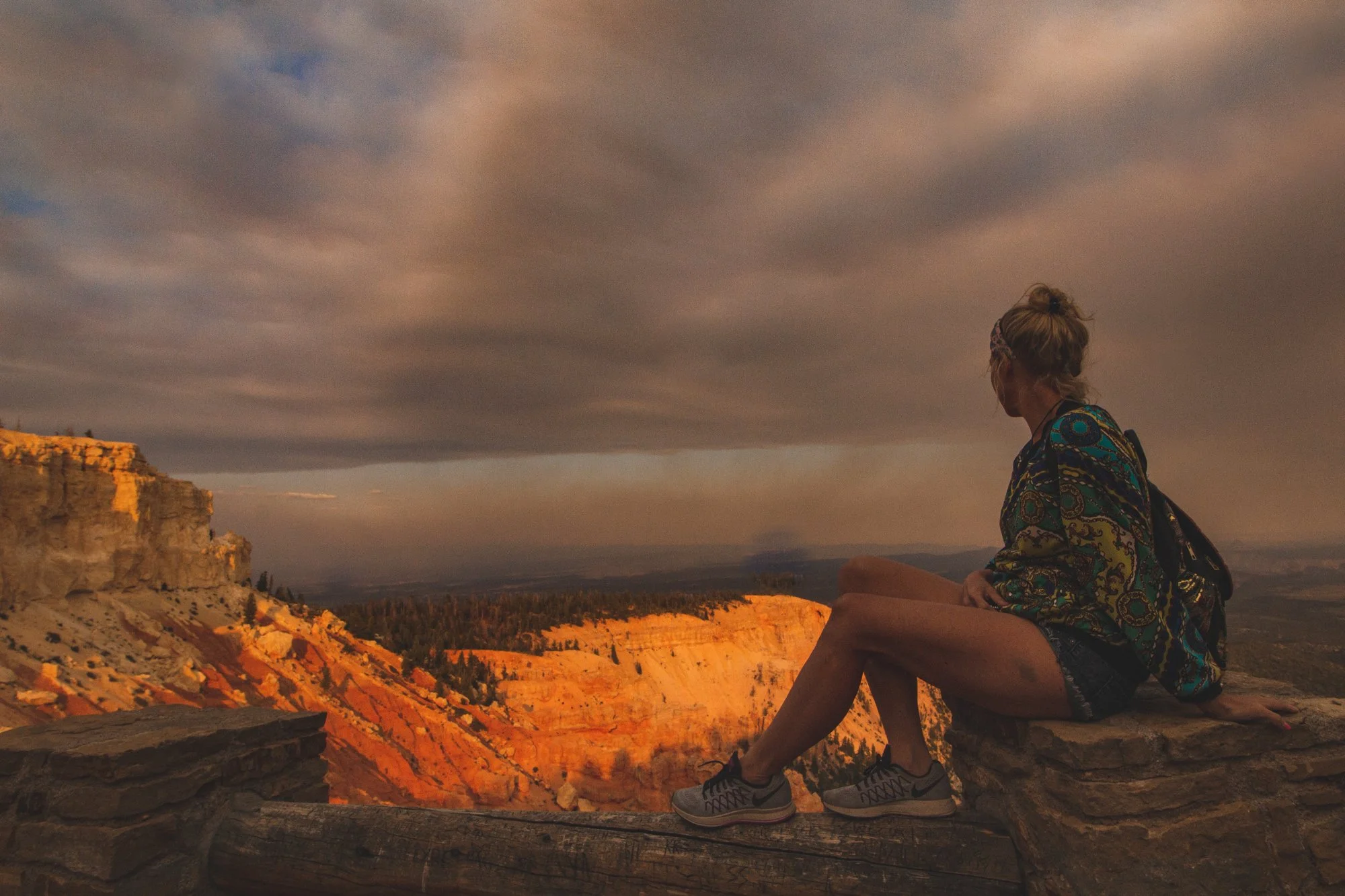
We were able to take advantage of the nearly 9 PM sunset time in June and discovered the best way to spend one day in Bryce Canyon National Park in the Spring / Summer season. The views were stunning, colors struck a vibrant chord, and the golden hour saturated the skin and sky.
This spontaneous pit stop proved well worth the sunny day visit, though I will have to return again sometime in winter to experience the mystic icicles and snow-topped hoodoos, the eroded rock pillars that Bryce is famously abundant for.
Enjoy my guide on how to spend one day in Bryce Canyon National Park… and you don’t have to wake up at 6 AM to do it. We’re living life on mountain time now, baby!
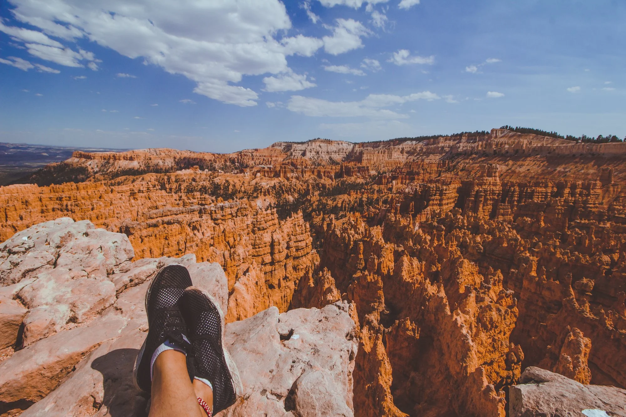
Immediately upon entering the park, you are greeted by Bryce Amphitheater, the orchestral valley with red, orange, and yellow hoodoos stretching as far as the eye can see.
Jump out and stroll along the Sunset to Sunrise trail for one mile of epic photo opportunities along the entire perimeter.
Potentially the most popular trail in Bryce Canyon, this 2.9-mile combination loop welcomes visitors embarking from Sunset Point to witness surreal changes in the earth’s landscape with striking caverns and monstrous structures that possess these distinctive names.

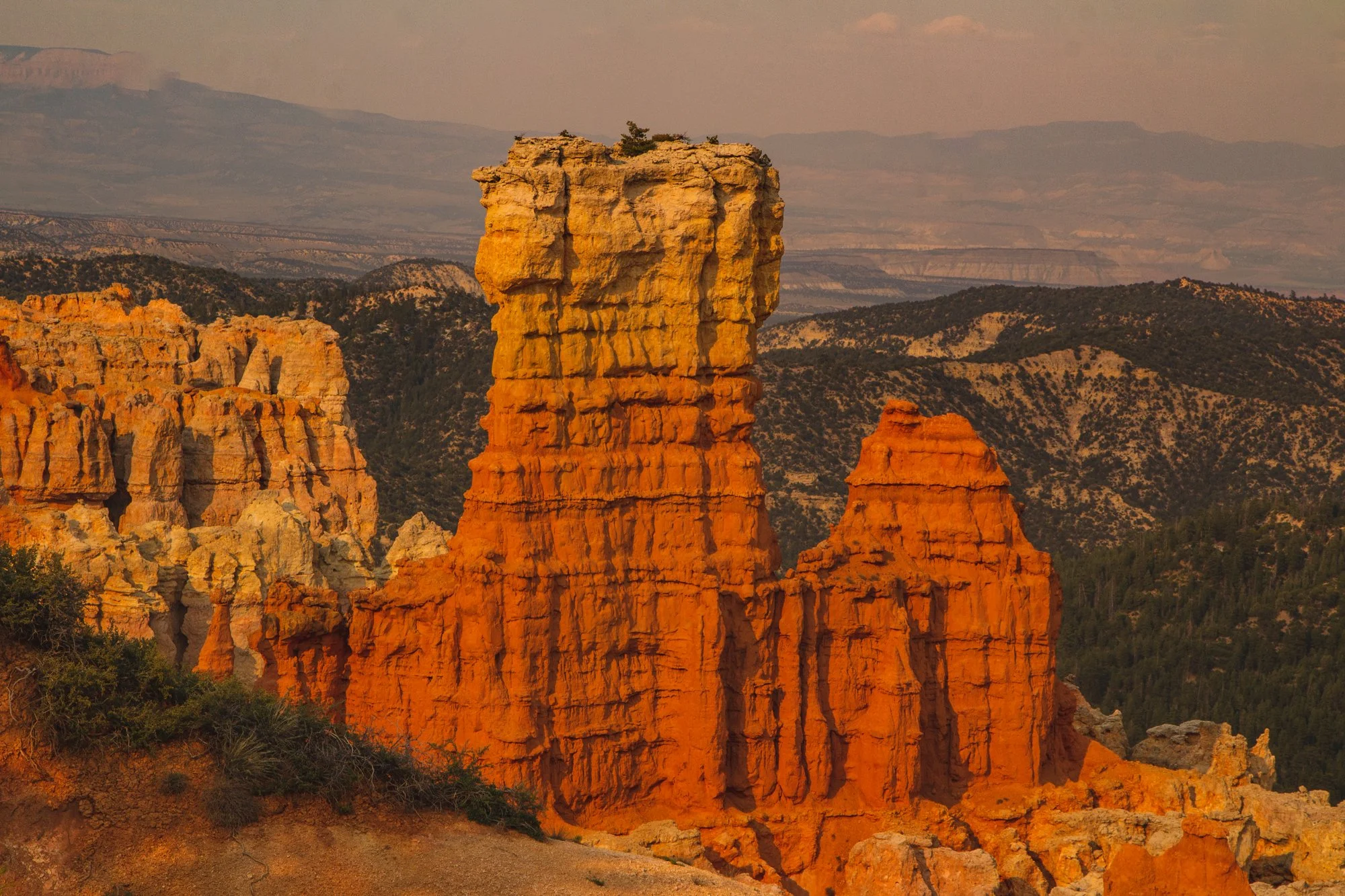
Highway 63 spans 18 miles of stunning viewpoints, the next being Inspiration Point and Bryce Point.
Look for the arches and windows formed by hoodoos that categorize each landscape unique.
Wildlife roams freely through the park, with dozens of species of bird, mammals, reptiles and amphibians. We spied mule deer, blue jays, ravens, lizards, squirrels and luckily, no Great Basin Rattlesnakes. If you are fortunate, you could even encounter porcupines, foxes, or even the endangered California Condor.

While this hike through the quiet backcountry is 4 miles, you can briefly cruise through the tree-lined trail for as long as you desire before turning around, to steal a taste of the terrain.
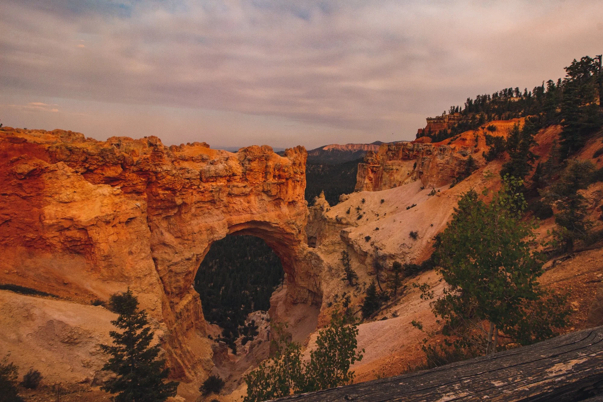
Natural Bridge became my favorite viewpoint of the entire day and features the attention-grabbing arch that steers your eyes into the valley. Agua Canyon is just a half mile down the road and full of imagery reminiscent of Dr. Seuss’ timeless book, Oh, the Places You’ll Go!…
Rainbow Point earns its name from the myriad of colors emitted from its topography: dark green trees mixed with whites, reds, and orange natural amphitheaters.
Our jaws dropped at the panoramic view before we moseyed through the 0.8 mile Bristlecone Loop, a partially shaded walk decorated with fir forests and bristlecone pines, like a winter wonder dream in the Summer.

End your excursion at Yovimpa Point, where the Grand Staircase peeks at you from underneath layers of rock. The Pink Cliffs, Grey Cliffs, and White Cliffs would make this point a more fitting name than Rainbow Point.
hi wolfette, i’m molly
Travel is a spiritual experience for me, especially when adventuring solo.
After visiting 6 continents on my own, I’ve dedicated this project to assisting other Lone Wolfettes on their journeys.
I hope my travel guides help you find the same joy, connection, and empowerment as exploring our planet has given me.