road trip

11 Free Things to Do on your Big Sur Drive in California

Are you heading on a Big Sur drive soon? Do you love waterfalls, hiking, beaches, wildlife…

…and being out of contact from the rest of the world?

Then read on because I am about to share my secrets with you, fellow budget traveler, with these 11 free things to do along the remote coast of Big Sur, California.

I’m a California native who has driven allll the way up and down our large state (from Mexico to Oregon and back) several times - both on my own and with friends.

I’ve written this article from my own recent experience doing the Big Sur drive post-pandemic with a friend. The untouched beach bluffs that greet you with a different personality every morning remain a photographer’s dream!

Note: Before you hit up these free things to do on your Big Sur drive, you absolutely need to make sure you have maps downloaded offline since the internet will not work at all on this remote coast. You can use the free app maps.me to download the map of California. Make sure you save all these locations beforehand, so you have all the hiking trails and campsite locations. You’ll need them.

Now, get ready to hit the road!

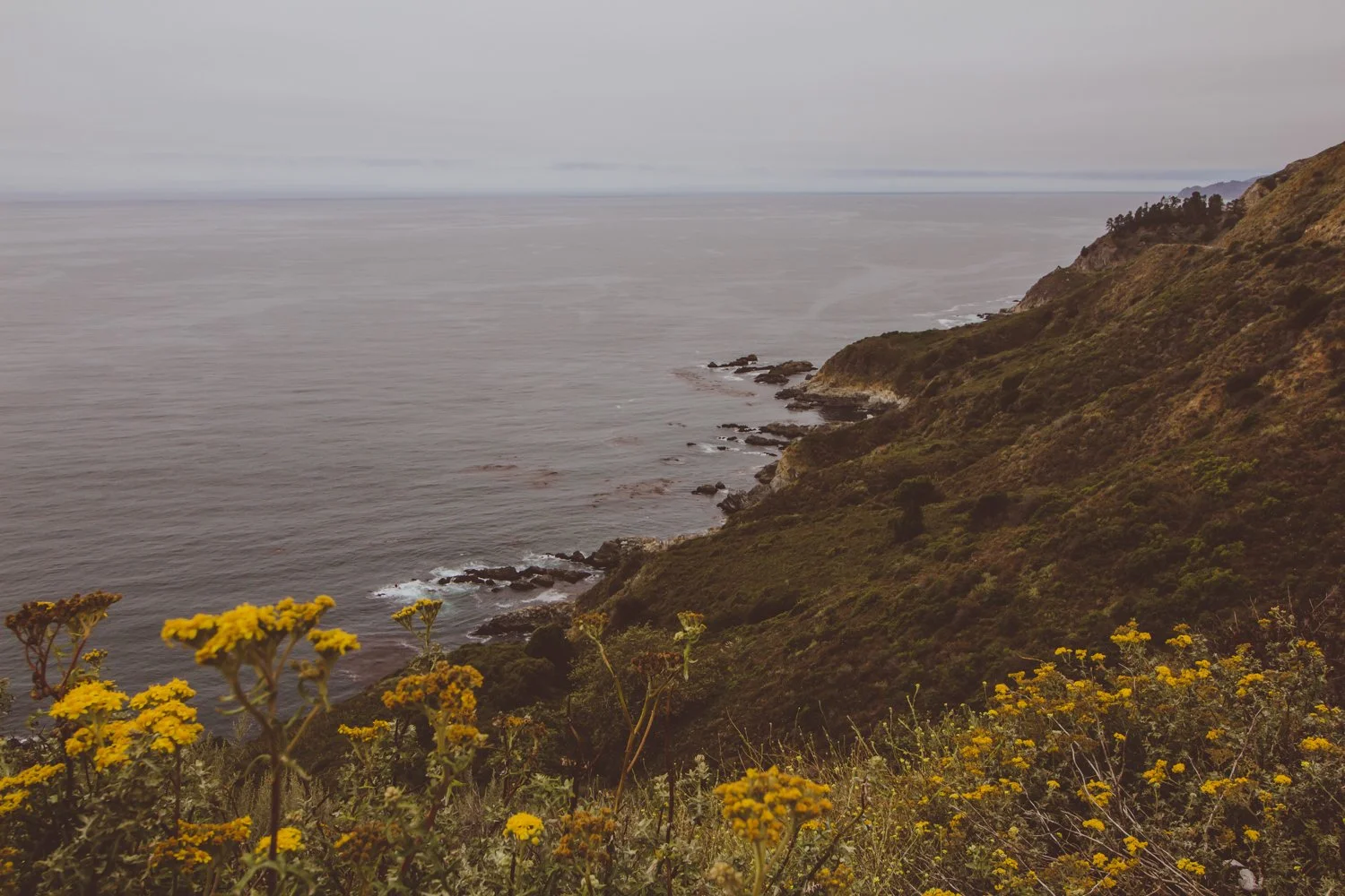
view of the pacific ocean from big sur drive on highway

Your Big Sur drive is the place to unplug, get lost, and find your spirit along the unforgiving coastline.

The Mystical Big Sur drive

Dark, brooding beaches exist without another pair of footprints in sight.

Purple sand sprawls next to thick sea stars chilling on rocks, while miniature crabs scuttle about.

Sparkling lime waterfalls surprise hikers at the end of miles and miles of overgrown forest trails.

And bushels of poison oak claw at you from every corner.

I spent 5 days with no cell service exploring the longest stretch of undisturbed coast in the United States: Big Sur, California.

90 miles along Pacific Coast Highway 1 in Central California from Carmel to San Simeon brims of rocky beaches with character and redwood mountains so steep they’ll bang up any car smaller than a Jeep.

Upon arrival, it is easy to understand why Big Sur glitters majestic.

For rugged campers or backpackers, the solitude experienced on the Big Sur drive is a dream. You must have an offline map to find your way around the less-visited landscape, while families will probably stick to the state parks.

Besides privacy, the preservation of the area maintains that Big Sur will always stay true; the flora and fauna will (hopefully) continue to flourish, and it gives people a chance to see how beautiful California would be without infrastructure.

rocky yellow beach with blue water and sky

Lastly, Big Sur wows due to its affordability. If you are craving a getaway and know how to pitch a tent, you can visit Big Sur for the price of food and gas.

I will note that state parks charge $10 for cars, but there are ways to get in free as well which I will detail below.

Ok Wolfette, here are 11 free things to do on your Big Sur drive in California, from a local:

11. Observe the Elephant Seals in San Simeon

Location on Google Maps: Elephant Seal Vista Point

elephant seals lying down on beach shore

Those aren’t rocks… they’re elephant seals laying down!

Our first Southern stop on the way to Big Sur proper was an unexpected turn at the Elephant Seal viewing area in San Simeon.

Don’t let the mellow photo fool you. These elephant seals play-fought in the water together and bounced along the shores until we experienced cuteness overload.

Yes, it’s free like everything else on this list. You’ll just stop on the side of the highway for your up close encounters with wildlife.

10.  Swim at gorgeous Salmon Creek Falls

Location on Google Maps: Salmon Creek Trailhead

Hiking distance: 0.3 miles

waterfall at salmon creek falls

Wow! These gorgeous, green falls at Salmon Creek reside just a short walk from highway 1, so no strenuous hiking is involved.

Keep an eye out as you map your Big Sur drive, because you’ll have to quickly park at the side of the road (no parking lot) on a busy bend of highway.

Wade, swim, and jump in the emerald pool to cool off. If you desire a longer hike, you can continue up the trail to Upper Salmon Creek Falls, about 5 miles round trip.

9. Slide down Ragged Point and enjoy a private beach

Location on Google Maps: Ragged Point Inn & Resort

Hiking distance: 0.8 miles

Ragged Point is a steep hike that leads you down the cliff to a gorgeous, quiet sandy beach where you will probably be alone, due to the nature of the trail.

You will park in the same parking lot as Ragged Point Inn & Resort, with the trailhead behind the hotel.

To make the descent safely, you’ll want athletic shoes with traction since the loose dirt tended to slide underneath your feet.

We had fun stomping and jumping around the round rocks at the bottom and finding our own hideaways for about an hour.

8. Discover hidden Redwood trees at Redwood Gulch

Location on Google Maps: Nathaniel Owings Memorial Redwood Grove

Hiking distance: 0.6 miles

We missed the stop at Redwood Gulch, because no sign warned us along the road. After turning around and going back to the coordinates of the unmarked turnoff, we spotted a thin beige path.

This unassuming path led us to the location of the southernmost Redwood trees, lining a watering hole perfect for a skinny dip.

rocky shells on forest ground

The humble falls and musky forest seemed to be plucked out of a fairytale. (Any 90’s babies remember the cartoon forest nymph, Fern Gully?).

7. Slink in the caves at Sand Dollar Beach

Location on Google Maps: Sand Dollar Beach

Sand Dollar Beach might possibly be our favorite beach in California.

We discovered several spacious caves on the edge of the beach, large enough to walk around in and relax. The caves resembled secret auditoriums, a shaded paradise away from the world while we lazily peered out at the blue horizon.

In addition to private caves, the beauty and adventure lured us in. The water appeared so clear and pristine that you could see each grain of sand beside your toes. The sky reflected off the sand, projecting an infinite sapphire vortex.

To avoid any fees, simply park on the street outside of the parking lot.

6. Camp above the clouds

Location: Hidden (Details below)

camping above the clouds in big sur

Big Sur’s low-brewing clouds prove eerily reminiscent of a James Bond film, paired with boosted high mountains that call in the heavens.

Although most official campgrounds were listed around $40-$70 per night, you can save the cash and camp for free in several astounding locations throughout Big Sur.

Instead of giving away all the secrets here and exposing the spots, I recommend you use the apps and websites Campendium, Boondocking, or freecampsites.net to check out the updated campsites that other reviewers have listed. These are the tools I always use on my primitive camping journey, along with maps.me.

A lot of these camp spots require a four-wheel drive vehicle to reach them (we learned the hard way) and may be unofficial, but they will usually be free.

Other non-free options include looking on Hipcamp (like Airbnb, but for camping) or camping within the state parks and official campgrounds (Kirk Creek campground has an awesome view!).

5.  Take a magical hike along Mill Creek

Location on Google Maps: Mill Creek Trailhead

Hiking distance: 2.3 miles

Zip down the mile-or-so-long trail to quiet Mill Creek, where you can walk-in camp or just chill by the creek in a forest-flooded daze.

The forest quickly transformed into pages of a storybook: illustrations depicted sleeping wood, golden sunlight peaking through the standing beauties, and viney grottos to soak in.

We plummeted to the bottom of the valley and turned left along the creek, following the water’s way to increase the trail length. Just watch out for poison oak and snakes along the way (and bring warm clothes for after that icy fresh bath, even in Summer.)

4. Prance in purple sand at northern beaches

Location on Google Maps: Andrew Molera Beach or Pfieffer Beach

purple sand bluffs at andrew molera beach

Our Big Sur drive displayed a rainbow of colors, from purple sand to green forests, blue skies, and orange Golden poppies.

The rose tinted bluffs, like in the photo above, scatter purple sand along Pfeiffer and Andrew Molera beaches.

You’ll have to visit the beach to find the most concentrated areas, where the sand is literally bright violet.

3. Tread in the Big Sur River

Location on Google Maps: Big Sur River Gorge

Our beloved sun’s UV rays don’t take the day off even when the weather is overcast, so we sought a brief whisper of shade along the Big Sur River.

The River Gorge forms a swimming hole in crystal clear pools after a mellow trail.

2. Visit the renowned state parks

Seeking a remote escape, travelers can receive free hugs from the wildflowers, arbors, and aquatic bodies that live in Big Sur’s state parks.

Winding miles and miles of trails in these state parks each tell their own chapter in Big Sur’s anthology.

golden poppies in front of ocean on big sur drive

While most of the parks are $10 for cars to park, you can instead park on highway 1 and enter them for free on foot (except for Limekiln: no walk-ins).

If you do decide to purchase the $10 parking pass for any of the following parks, the pass is valid for any of the other parks on the same day - essentially free.

Limekiln State Park

Location on Google Maps: Limekiln State Park

Arrive before 10AM to get a parking spot in this southern state park.

Skip over to Limekiln Creek Falls for a dreamy staircase of cascades, and follow along peaceful Hare Creek for a 2 mile nature walk.

Pfeiffer Big Sur State Park

Location on Google Maps: Pfeiffer Big Sur State Park

The Pfeiffer Falls and Valley View combination route guided us to a modest-falling spout, though nonetheless enchanting, and a sunny lookout to reward our sweaty backs at the top.

The most well-rounded journey is Buzzard’s Roost trail, a spellbinding path sprinkled with young redwoods, tricky hills, and the Big Sur River welcoming you at the front door.

Julia Pfeiffer Burns State Park

Location on Google Maps: Julia Pfeiffer Burns State Park

The picturesque McWay Falls graces postcards and magnets as an icon of Big Sur proper.

Besides the falls that tumble onto a scenic, teal beach, the park charms with a secluded silver bay and cliff-hanging trails.

Andrew Molera State Park

Location on Google Maps: Andrew Molera State Park

Combine the Beaches (easy), Bluffs (moderate), and Ridge (strenuous) trails for a heart-beating 8-mile adventure, or simply pick one to wander along.

If the fog clears out along the Ridge trail, you’ll get a panoramic view of baby blue waters among the fragrant foliage — though you’ll have to climb dozens of flights to earn it.

For a less mobile day, indulge in pure beach access at Molera Point.

1. Pick your own seascape spot for an epic vista picnic

Location: Anywhere there’s a turnoff

foamy shoreline on big sur drive

The Big Sur drive is full of epic views like these, with no one else around…

Sometimes, the most precious pleasures are the freedoms you create yourself.

Roll up a quilt and tuck in sandwiches, muffins and hot coffee. Simmer over to a turnoff on the coastal highway, and enjoy a picnic overlooking one of the last natural places in the world.


hi wolfette, i’m molly

Travel is a spiritual experience for me, especially when adventuring solo.

After visiting 6 continents on my own, I’ve dedicated this project to assisting other Lone Wolfettes on their journeys.

I hope my travel guides help you find the same joy, connection, and empowerment that exploring our planet has given me.


Related articles

Yosemite in November | Best Things to do in Autumn

Central California’s Yosemite National Park was the third area to be declared a national park in the United States in 1890, properly preserved for its abundant wildlife and rugged beauty.

Yosemite is famous for its colossal granite mountain faces, frothy waterfalls and enormous Sequoia trees. The park’s serene setting is a magnet for adventurous backpackers making their way up the John Muir Trail, as well as groups visiting from around the world to camp in the Valley and see the main sites.

We visited the park in late October 2020, which had its advantages, but also its drawbacks — both of which I will detail in this article.

Here is a snapshot preview of our trip to Yosemite National Park during COVID times: the pros, the cons, and the best things to do in Fall.

Camp in Aspen Grove

We entered the park at the east entrance near Mammoth Lakes, California at an icy 9,000 feet altitude – a chilly welcome, yet with many advantages.

Right near this entrance lies Aspen Grove – a secluded campground tucked away in the quiet forest. 

A rocky creek splashes beside the sites, breaking up the stillness of the cool air.  Copper, orange, and rustic red trees are spiced along the stream.  Fallen limbs brim the water’s edge where nature has run its course.

The weather temperature dropped below freezing that night, but the soft sunrise that peaked through hard branches was worth the extra frost.

Lounge at lakes along Tioga Pass

Majestic waters awaited us along Tioga Pass, the scenic stretch of highway through the park that stays open until snow season around November.

We stopped for photo ops of the freshwater beauties, the perfect royal blue backdrops.

I was dressed in so many layers of chunky sweaters and scarves and snowboard pants, right before the sun suddenly sneaks out and surprised us.  We even saw other hikers wearing shorts as we unraveled a million layers off our body!

Trek up Cathedral Lakes Trail

This steep climb will have you ascending around 1000 feet per mile.  With crisp mountain air as our fuel, the hike to Cathedral Lakes and back is 8 miles roundtrip, even with the big hill!

Spoiler alert: with a 30-pound “Phatty” the pooch in tow, we never made it to Cathedral Lakes – but mainly because the Autumn sundown creeps in early at 5PM (no worries, Phatty).

Fall in love with Bridalveil Falls

The only waterfall that still flows in Autumn is Bridalveil Falls, as all the other cascades have dried up over the summer without rain. 

Currently, Bridalveil Falls is currently closed in 2020 for construction (can’t catch a break this year, can we?).  However, the falls are still beautiful to glimpse from afar until the trail opens up again.

Crawl into a Hollow Tree in Mariposa Grove

At the bottom of a lonely canyon lies the Mariposa Grove of Giant Sequoias, a haunted walk of fallen leaves and silent giants. 

We stumbled upon an old tree with the insides hollowed out.  Though I can be claustrophobic, I can cross off my bucket list that I have crawled through a tree longways like a tunnel.

Be aware, the 2-mile hike back out of the valley grove proves quite steep!

Frolic and splash among Autumn colors

Speaking of trees, what list of Autumn moments would be complete without including jumping in a pile of crunchy orange leaves?!

Honestly, the best thing about visiting Yosemite in Fall is the spectrum of colorful shades.  The contrast of dark and light shades in Yosemite’s lakes, peaks and trees is stunning.

Gaze up at Granite Domes

The most striking feature of Yosemite National Park is the epic granite domes that tower over visitors in Yosemite Valley. 

These chalk-colored monsters were shaped from glaciers that swept over the granite during the ice age, along with erosion, forming huge domes.

Take the trail along Mirror Lake for protruding views of the gargantuan Half Dome, or stop in the valley meadows to look El Capitan in its 3,000-foot face.

Dance, sing, and play music in the park

With less crowds in the Fall, we often had the trails to ourselves in the late afternoons – besides for the thriving animals and plants, of course.

We danced with hula hoops through private corners and played flute to echo among the trees, listening to the sounds of the forest speaking back to us.

In a nutshell, or an acorn, the best way to spend your time in the park is by carving out your own adventure on the trails less traveled by (with less visitors in Fall) and making the most of the off season (through cold weather and COVID times).

You will find there is always something unique to discover in Yosemite National Park!

Strange Things to do in Salton Sea, California | 8 Sights of a Ghost Town

Abandoned resort towns. Off-beat desert art. Lawless societies.  

Southern California’s Salton Sea is a 3 hour drive from Los Angeles, yet the communities near this salty body of water resemble that of a different world.

And different – or ‘strange’ – is a beautiful thing.

tv art salton sea

Slab City’s Wall of TV’s in East Jesus is one of the most photographed exhibits near the Salton Sea.

Wondering about the best sights to see in this otherworldly ghost town?

This article covers the raw and real account of our 2-day adventure to the desert, including my favorite things to do in the Salton Sea area, from Bombay Beach to Salvation Mountain.

While the summers swell over 100 degrees Fahrenheit in the Sonoran Desert, the winters bring adventurers out to the dry land for unabashed living, free to roam independently.

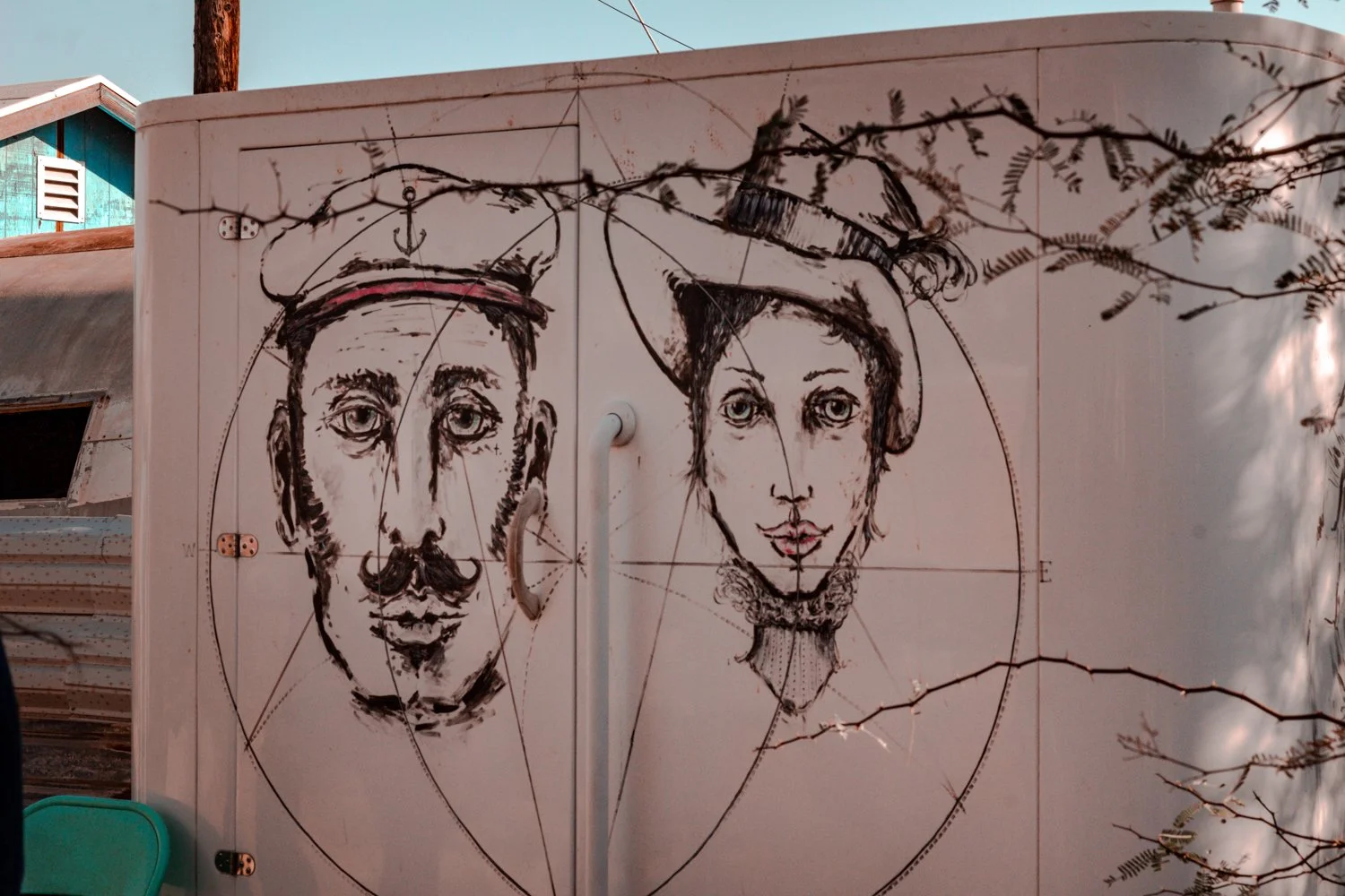
steampunk art on back of trailer

Finding hidden steampunk art was one of my favorite things to do in the creative district.

We left our urban home of San Diego at dawn and made it to the desert early for some quiet time and uncrowded photos.

Though we didn’t scour every single corner during the weekend, here are my favorite things to do near the mystical Salton Sea.

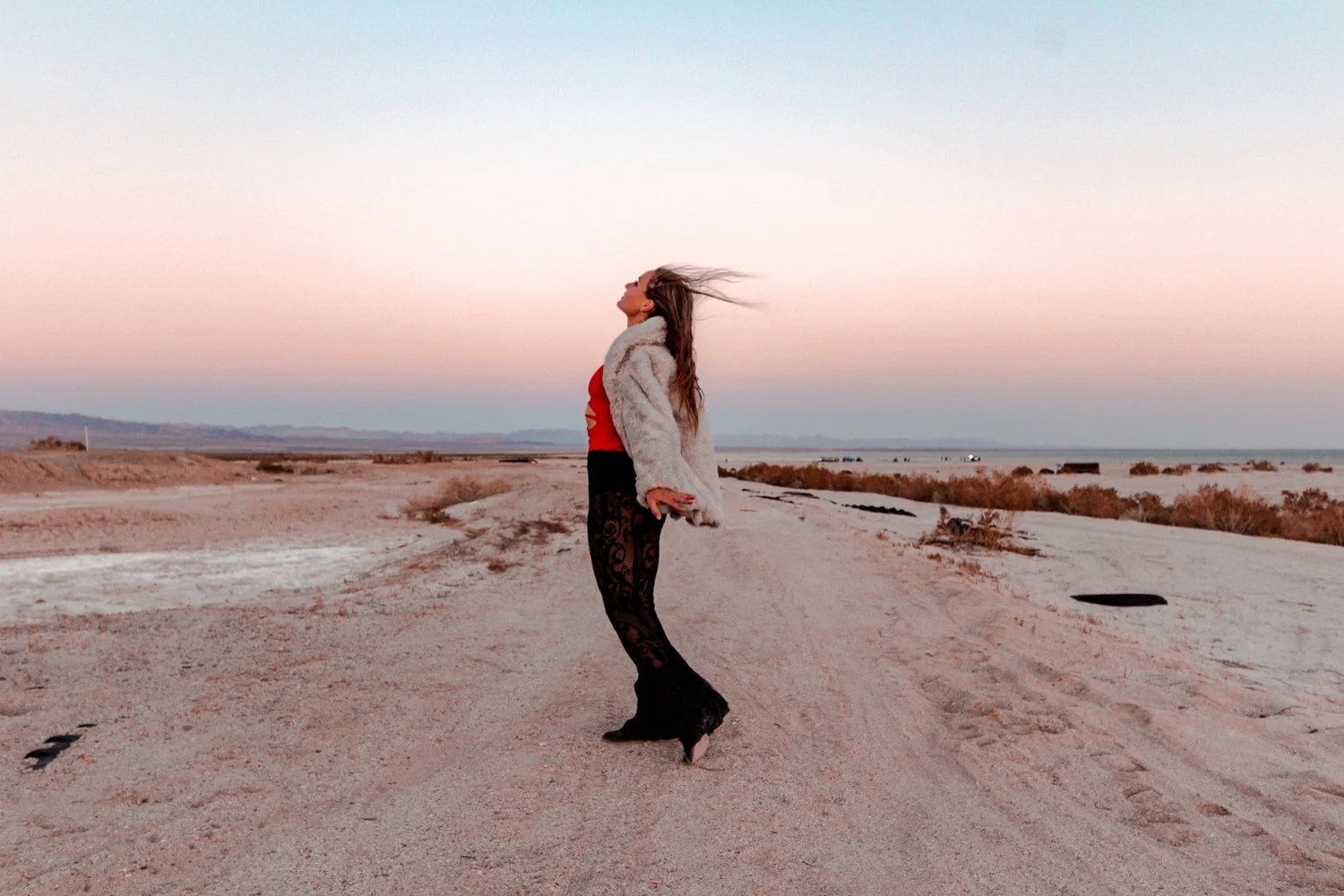
standing in the wind during desert sunrise

Getting up for a sunrise photoshoot was absolutely worth it.


1. Stroll the Legendary Salvation Mountain

salvation mountain

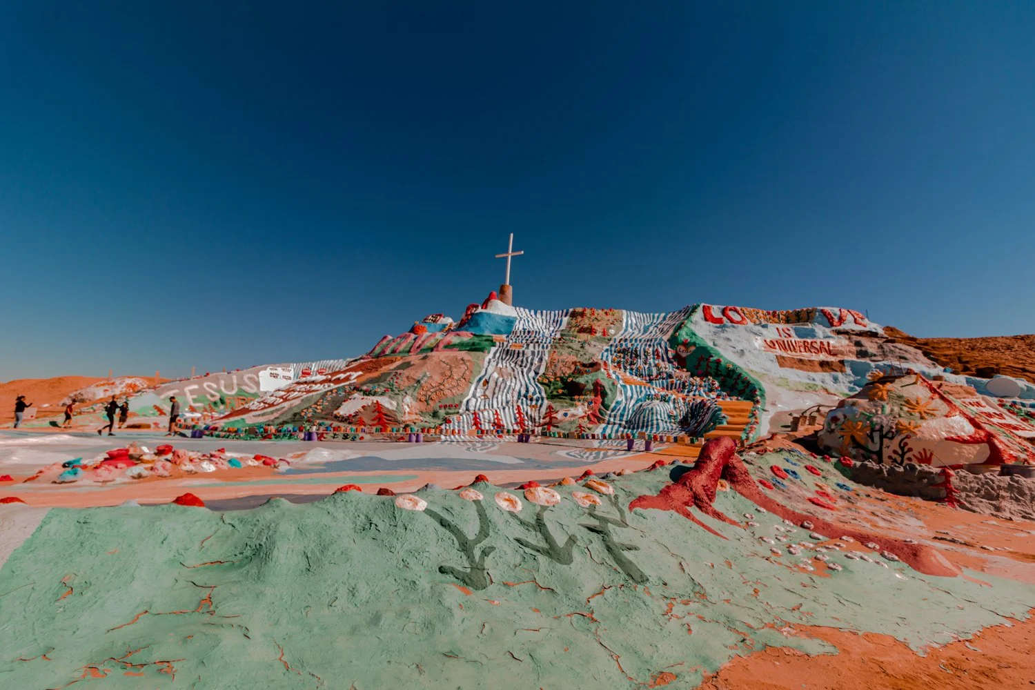
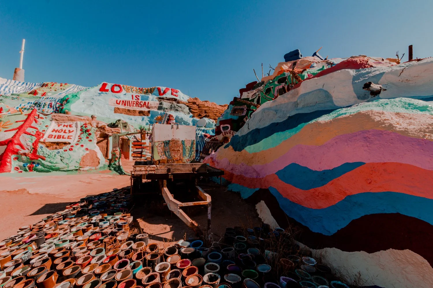
Salvation Mountain is Leonard Knights’ life work and homage to God in the middle of nowhere.

Colorful Dr. Seuss vibes dazzle Salvation Mountain out in Imperial County’s desert.

The biblical mountain was built by the late Leonard Knight who spent over 20 years building and painting the structure out of his pickup truck in the unforgiving desert.

The first hymn-covered hill he constructed actually collapsed after 4 years of work because it was built on sand.

Afterward, he carefully started over, saying it was God’s will for him to share these messages despite the obstacles.  His handiwork demonstrates perseverance and dedication, reminding me of the Old Testament story of Noah’s Ark.  

views of salvation mountain

Lots and lots and lots of paint.

I’m thankful Leonard never gave up on his life’s work, as his writings of love and hope shine vividly today.

Note: Part of the hill was under construction and not fully open when we visited.

2. View trash-turned-treasure in Slab City

I admit it felt a bit uneasy to be stepping foot in the lawless land of Slab City for the first time.

 
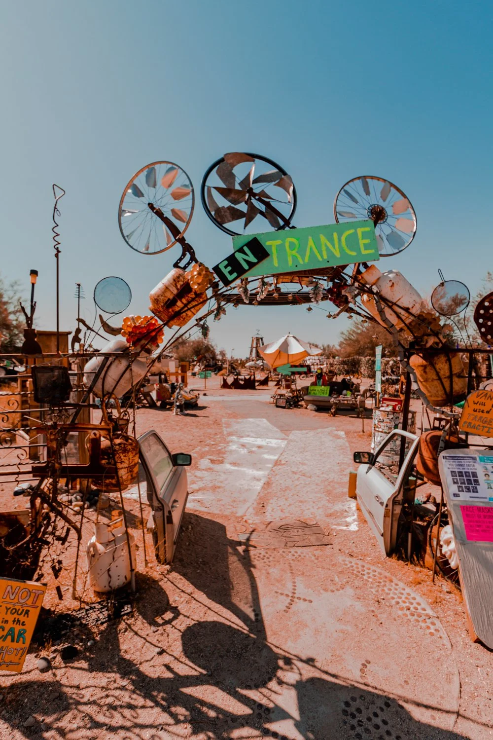
entrance to slab city

Visiting Slab City is a must on your Salton Sea itinerary.


Just a quick hop and a skip down the road from Salvation Mountain lies the unincorporated boondocks of Slab City, the modern day village where retirees, nomads and snowbirds have gathered for decades in the Southern California desert.   

But the first thing we saw as we drove up the main road in our bright sedan eased our nervous qualms. 

art car slab city

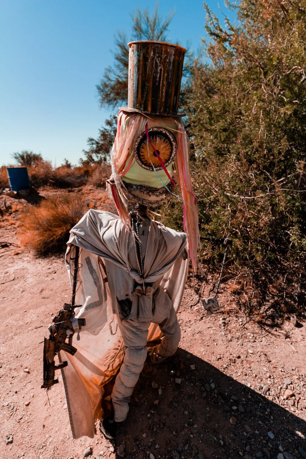
Everything is art in Slab City, home to the alternative souls.

We were welcomed by a young woman playing banjo on a couch near the main entrance to the community.  Her platinum locks and puffy princess dress stood out from what looked like a crowd tailgating on the side of the road, or an RV park version of a neighborhood block party.

The town’s moniker refers to the concrete slabs that remain left over from a World War II military base, now inhabited by squatters.

 
alien salton sea

I want what he’s having…


3. Ponder the East Jesus exhibit

Striking. Resourceful. Beautiful.

The ever-changing East Jesus exhibit on the edge of Slab City is a gallery of treasures crafted from another’s trash.

Old vehicles become furry creatures, televisions transform into blank canvases for hand-painted messages, and tourists’ forgotten water bottles hang together for an art piece.

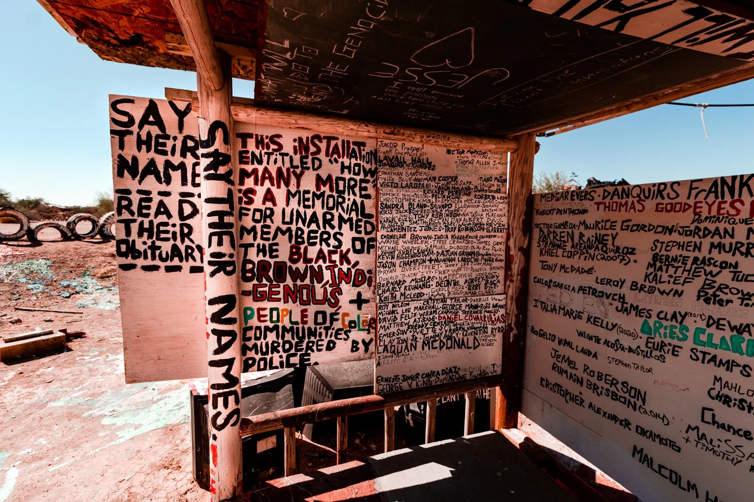
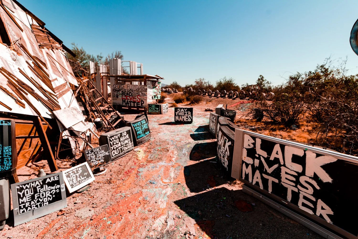
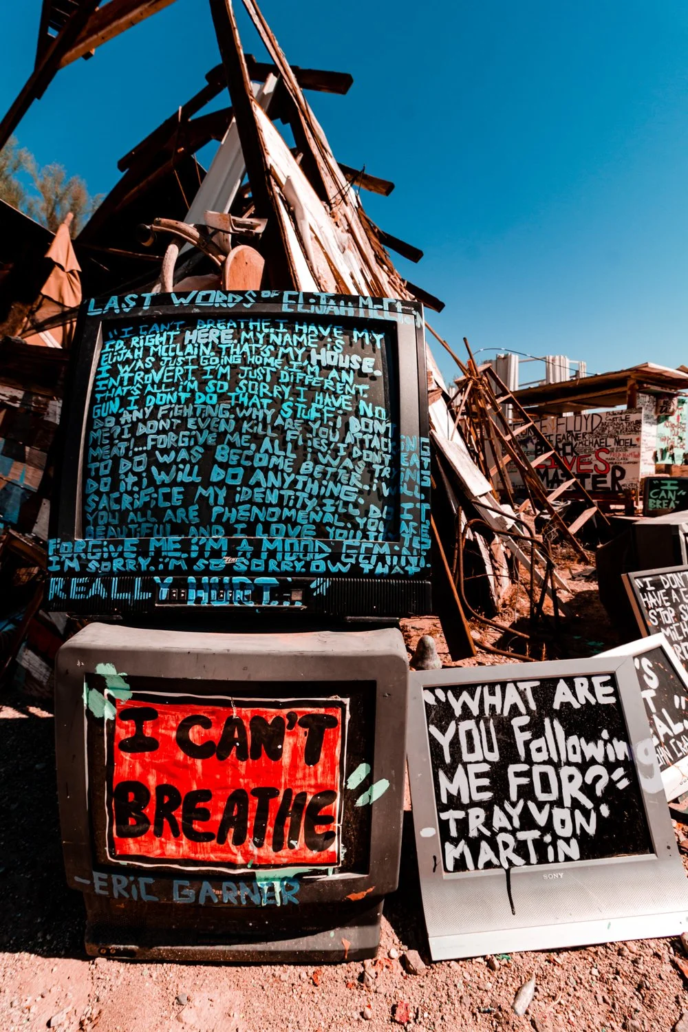
Contrasting with the whimsical pieces, a Black Lives Matter section a la 2020 rendered me speechless.  The last words from Black men and women before they were murdered by police both haunted and moved me. 

black lives matter exhibit
black lives matter exhibit in salton sea
black lives matter salton sea exhibit

Honestly, viewing the Black Lives Matter exhibit was the most memorable things I did in the Salton Sea area.


4. Spot the Salton Sea Sculptures

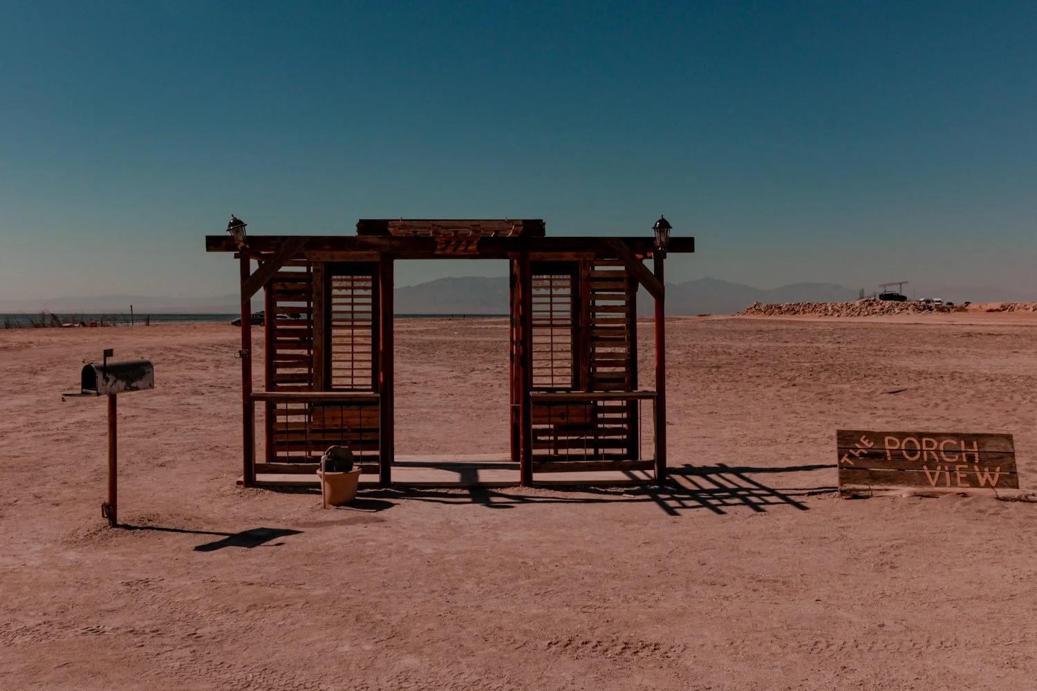
porch view sculpture on the beach

Along the Salton Sea, lonely swings and shapely sculptures perch along toxic waters. 

With no drainage, the sediment of surrounding sand oversalted the manmade sea, producing a deadly graveyard for fish and plants.

However, there are special nuances to the sea, despite the sulfuric smell.

Sunrises glow out of the water, something us Californians never experience on the Pacific Coast.

Antique furniture, doorways to nowhere, and anonymous transcripts left us smiling.  I felt at home and at Burning Man at the same time. 

5. Visit the Ghost Town Resort: Bombay Beach

Salton Sea actually used to be swimmable.  Bombay Beach, now a ghost town, brought celebrities in the 1950s like Frank Sinatra and the Beach Boys, and even offered fishing and boating.

After the sea turned toxic in the 1970s, the town emitted a post-apocalyptic energy, cluttered with remnants of what was once before.   

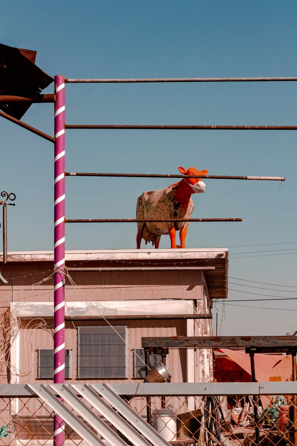
Though most visitors we saw simply drove through without stopping, we strolled around the hot desert town to find anomalies like upside down airplanes, mannequin scarecrows and a lot of displaced items on roofs.

 
cow on roof


6. Stay at the Zig Zag House

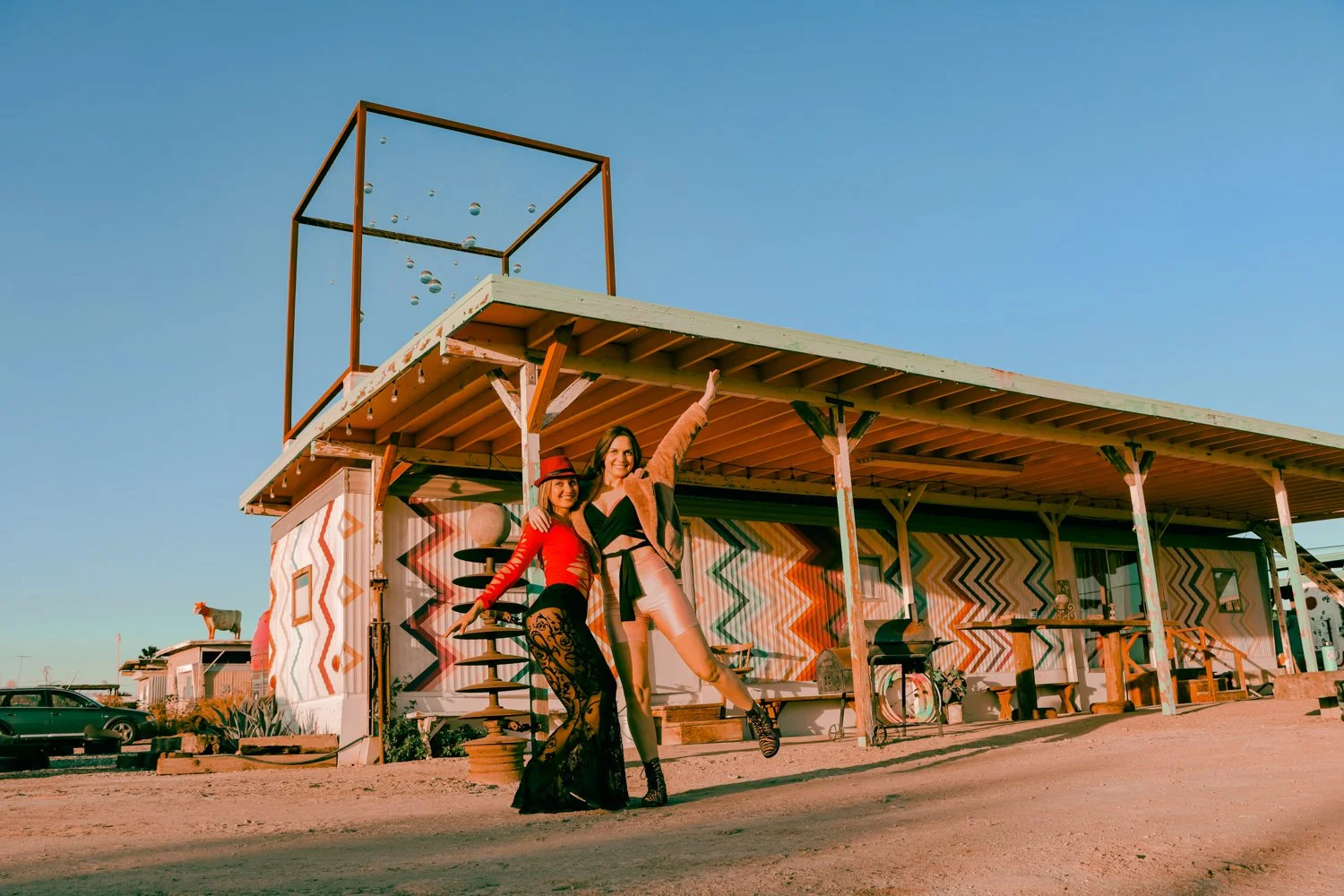
We stayed overnight at the Zig Zag House in Bombay Beach, thanks to our gracious host named Tao. 

zig zag house salton sea

Photo by Kirsten Pastel

Apparently, it’s a Pinterest-made-popular house since tourists were getting out of their cars to take photos of the puzzling-patterned trailer during our stay. 

zig zag house

We met individuals from all over who had come to take photos… including some of us!

posing in front of the zig zag house

I loved the charming red vibes inside the Zig Zag House, and all the enchanting elements of the exterior.

zig zag house bombay beach


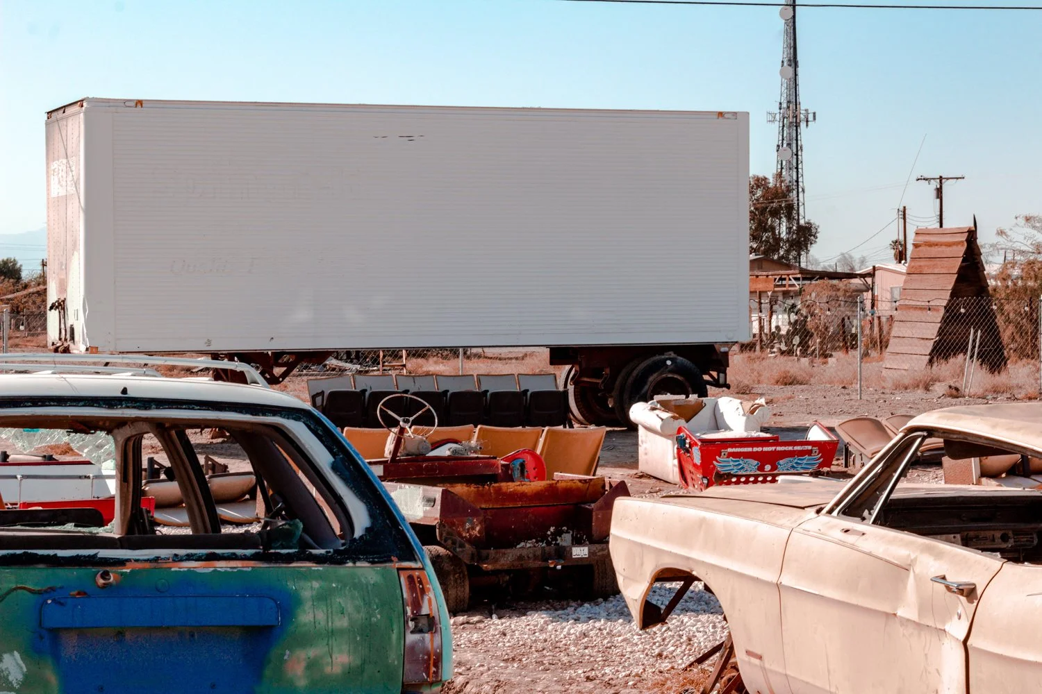
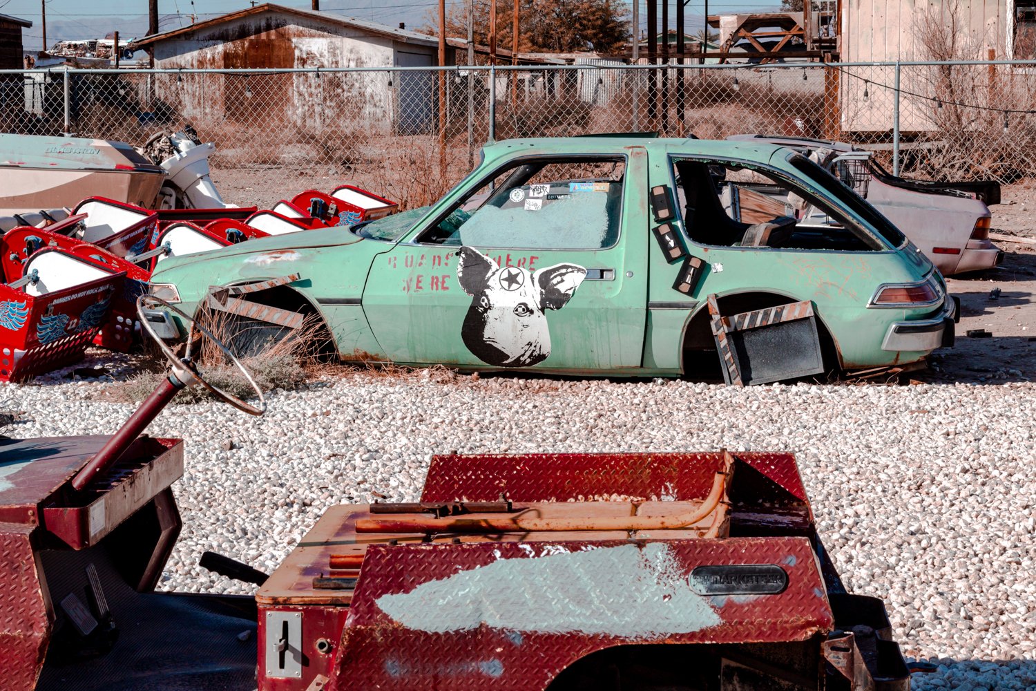
7. Sneak in the Drive-In

Is it a theater?  A junkyard?  Or a captivating art piece?

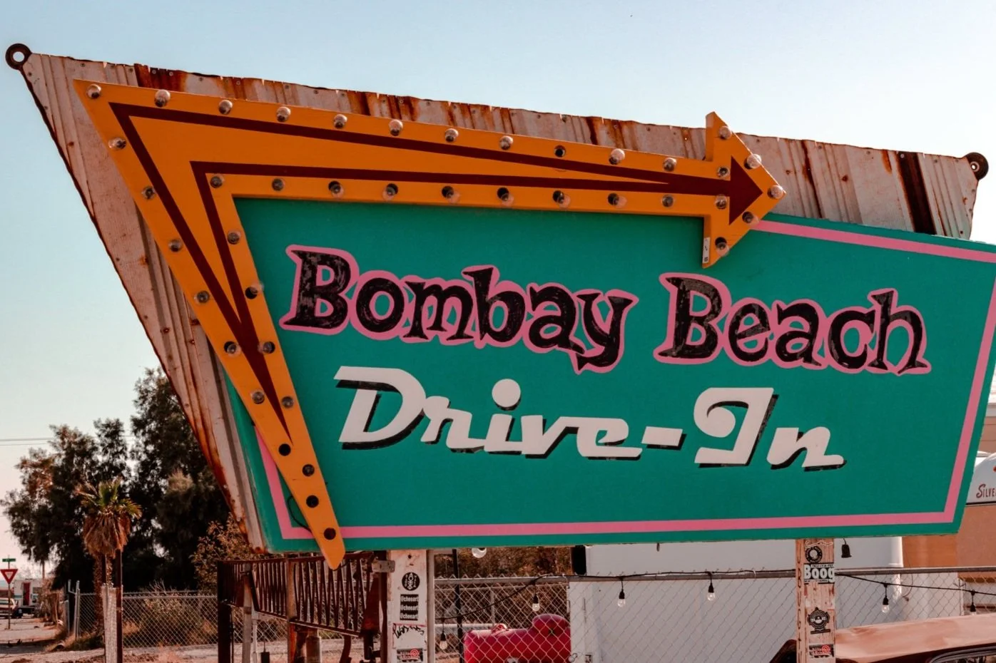
The Bombay Beach Drive-in left me with many questions. 

bombay beach drive in

I presume moviegoers left their vintage buggies a long time ago, and a new wave of artists decorated each car, mixing contemporary creations with nostalgia.

abandoned cars at drive in

Either way, you’ll want to watch your step.

8. Shoot the Estates

This doo-wop turned hipster town would not be complete without an array of abandoned buildings that any street photographer would salivate over.

bombay beach estates

The Bombay Beach Estates stand out, however, with the addition of the World’s Shittiest Museum.  

Like a decrepit art house, the ‘museum’ showcases a crass theme in every room. 

worlds shittiest museum

A putrid lime green room satirizes the phrase Cleanliness is Godliness with toilet brushes tantalizing the décor.

worlds shittiest museum

In other quarters, somber sayings sprayed on walls punch you in the gut with raw emotion.

the bombay beach estates

* * *


In today’s days post-pandemic, this trip was a fantastic getaway for those interested in ghost towns or provoking art.   All activities here were free, but you can donate with cash (or other treats) if you like at some of the exhibits.

artsy houses in the salton sea

The air out in Imperial County was eerily quiet at first, but grew peaceful as we stayed longer.  This was probably for the best, considering social distancing.  

While a bit risky heading out in the middle of nowhere, we met several kind folks who seemed like they sought to escape mainstream reality for a reason.

tv art bombay beach

And the strangest sight of all? Waiting for that pink sun to rise out of the mysterious sea.

pink sunrise salton sea

hi wolfette, i’m molly

Travel is a spiritual experience for me, especially when adventuring solo.

After visiting 6 continents on my own, I’ve dedicated this project to assisting other Lone Wolfettes on their journeys.

I hope my travel guides help you find the same joy, connection, and empowerment that exploring our planet has given me.


RELATED ARTICLES

The Perfect 3 Day Itinerary in Sedona, Arizona

Excited about your visit to Sedona, Arizona but not sure how much time you need for all the adventurous hikes, which parks to visit, and what activities are worth doing?

I am going to share with you the absolutely perfect Sedona 3 day itinerary that includes the best of this southwest destination’s top highlights: red rocks, natural waters, and energy vortexes.

Grateful for the energy this magical, rustic, vibrant place has given me.


How many days in Sedona?

An oasis for hikers, Sedona lures in travelers who stay anywhere from 2 days to weeks, calling them in to wander new crevices and caves.

When I visited this green, red, and orange destination in the Fall for my birthday (October 3 - Libra baby!), I found that 3 days was the perfect amount of time to experience most of the mystic area.

If you have an extra day, I’ve included a bonus day 4 to visit the magnificent Grand Canyon, as it is only 2 hours away from Sedona.

Oh, and the friends I road tripped with are late sleepers (despite my wanting to get up early for heatwave hikes)… so if you want to take things slow, just know that this itinerary leaves you plenty of time to relax as well.


I’ll try not to give all the secrets away… just remember to keep the wilderness wild.

Rock, water, and energy vortexes

But, wait a minute.

What the heck is an energy vortex?

New age folks claim that these vortexes are specific points on the earth that emit strong energy and inspiration from underneath the red rock. There are four centers in Sedona that are thought to host energy vortexes: Bell Rock, Airport Mesa, Cathedral Rock, and Boynton Canyon.

Intrigued by the concept, yet skeptical of anything other than first-hand experience, we crafted a plan to find out. We would visit Sedona and enjoy the world-famous landscapes, whether these spiritual energy centers were real or not.

Additionally, one of the best things we did when planning was to include bodies of water in our itinerary to cool off from the heat after camping and trekking (and sweating) all day.

As a result, our blend of hikes, vortex views, and aquatic time created a perfectly balanced 3 days in Sedona.


Cooling off in the afternoon swimming holes is essential after a hot hike.


Sedona 3 Day Itinerary

  • Cost: Midrange / Budget

  • Traveler Type: Any (Solo, couples, groups)

  • Days: 3 (plus option for a bonus day)

  • Interests: nature, hiking, mysticism

  • Transportation: car, walking


sedona arizona vista

Your perfect Sedona 3 day itinerary begins on one of the most beautiful highways in the Southwest United States. (Scenic Byway 179).

Day 1

Rock: Arrive in Sedona via Scenic Byway 179

Driving from California took us half a day, so we’ll call this Day 1. It’s best to arrive during daylight to soak in the stunning sights of Sedona’s scenic byway 179, so plan your road trip (or flight to Phoenix) accordingly.

You will pass the famous Chapel of the Holy Cross embedded in stone mountains as you head up north, so keep a look out!

Before you get to your first destination, there are a couple of things you should know.

First, most trails require a Red Rock parking pass for your car, which you can purchase at the visitor center or at most parking lots for $5 a day or $15 for the week.

bell rock canyon parking lot

The parking lot of Bell Rock Canyon was pretty empty in the sunny afternoon, even on a weekend.

Secondly, the least crowded time of day to hike surprisingly proved to be the afternoon. For once, sleeping in benefited us! By getting a slower start to the day, we avoided the swarms of morning folks on the trails. Additionally, by hiking in the afternoon we got to relish in the shade and sunsets, so the weather never grew overwhelmingly hot.

Lastly, before you hike anywhere, you should download the offline map of Sedona on maps.me. With no service on the trails, you don’t want to get lost in the heat, and it will help you navigate regardless. In this climate, bring more water than you think you will need and pack a hat, sunglasses, and sunscreen.

Energy: Bell Rock Vortex Hike

Welcome to your first vortex!

After a long drive makes you want to just jump out of the car and move around already, Bell Rock is the perfect hike to launch your hot, flaming rocket of an unforgettable desert trip.

Besides being claimed as an energy vortex, Bell Rock gives a stellar introduction to Sedona’s landscape. As you emerge from the highway, Bell Rock enchants the newly arrived explorer with vast previews of Eastern Sedona.

Climbing the looming face of the gargantuan rock stretches the views wider and wider, and you shrink smaller and smaller.

We reached Bell Rock via Big Park Loop, or you can take Courthouse Butte Loop trail, both ending up being 4 miles. However, the trails tapered off and became difficult to follow once you reach Bell Rock, so all the better to just carve your own way.

Both of these trails welcome all skill levels, remaining generally flat until the mountainous meet-and-greet.

So, did I feel the energy vortex?

bell rock

Bell Rock is known by some to be an epicenter of strong vibrations and healing energy.

The ridiculous height of the red rock towering over us chilled my spine enough to make the baby hairs on my arm bubble up. And the higher you get, the quieter the air becomes. Mountain silence as we stand on top of the earth.

Yes, it could have just been the breeze of the five o clock purple sky that grazed my soul shield, rather than an energy source. It’s difficult to separate the hefty pulse of excitement from what the “zonies” call a natural resource.

Water: Camp at Cave Springs Campground

Cave Springs Campground fills up quickly, so snag a reservation if you ever see one available!

Located a few miles north of downtown Sedona in Oak Creek Canyon, Cave Springs delights campers with a swimming hole, shaded forest ceilings, and much cooler temperatures than Sedona proper.

 
holding camera in the forest of cave springs

Happy to be in the shade at Cave Springs Campground.


We picked this campground for several reasons. First, it’s beautiful. Secondly, you can refresh in the water from the camp-side creek from the hiking trail that leads to different swimming areas.

Thirdly, when you wake up in the morning, you'll be super close to a wet attraction: Slides!

Day 2

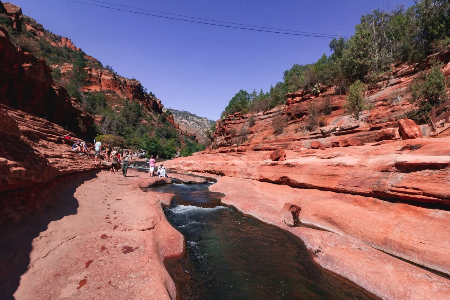
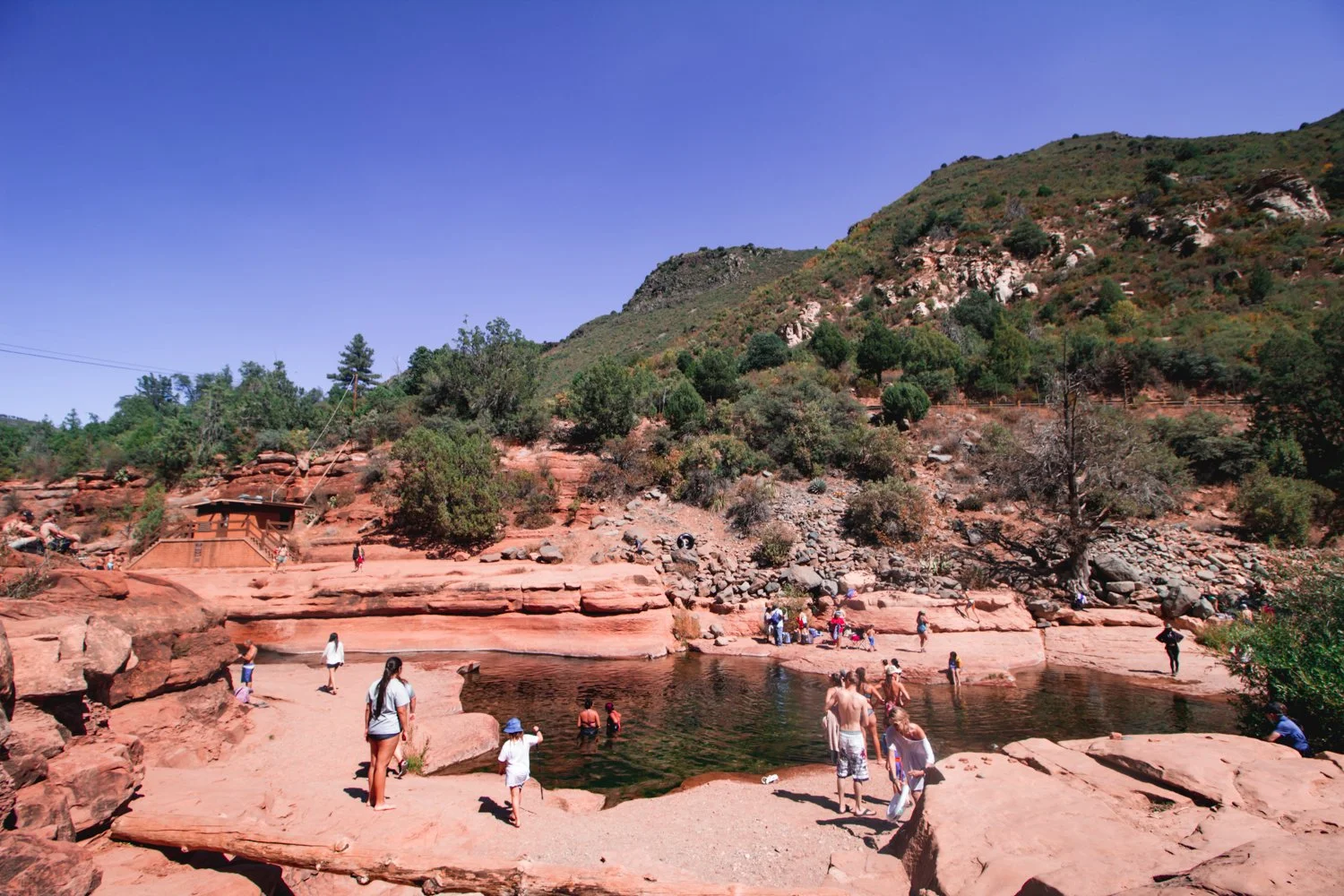
Water: Slide Rock State Park

creek in slide rock state park

This water was almost freezing cold in Fall but so worth it and refreshing once you jumped in.

Slide down a natural water slide carved into the earth’s wavy crest at Slide Rock State Park!

Exuberant tourists and locals cheered each other on as we each took turns sliding down the bumpy ride.

The dramatic turns seemed a bit questionable at first but somehow safe overall (though I wouldn’t bring a baby on it).

people standing along the river at slide rock state park

Be warned, however - the ‘slide’ water flows freezing! Well, not completely freezing, but the temperature remains between 40 to 50 degrees Fahrenheit, depending on the time of year.

Besides swimming, jumping off ten foot rocks into the ice bath, and zooming down that erratic slide, you can also hike trails in the park and absorb historical markers.

Next time, I would visit Slide Rock State Park in the Spring instead of the Fall, when the water is full of rainwater, in order to facilitate a smoother glide down that slide.

Rock: Devil’s Bridge Hike

  • Distance: 4 miles

 
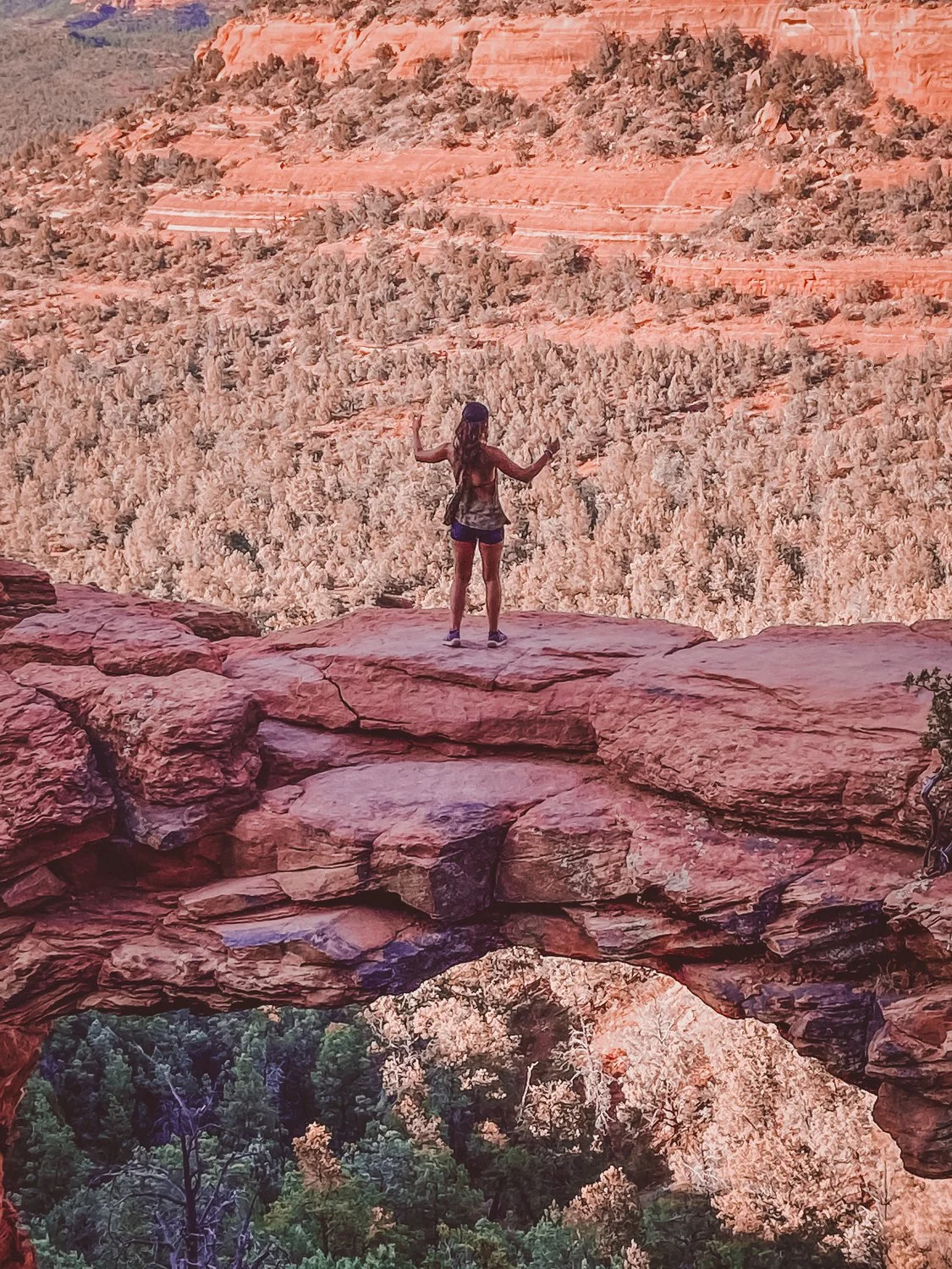
standing on top of devil's bridge
 

The ominous drop at Devil’s Bridge actually inspired my entire Sedona trip. Though I fear heights, the thrill of walking over that natural arch lured me in like a devil’s hand.

The 4-mile roundtrip hike gradually inclines at a steady pace, making Devil’s Bridge another approachable hike for almost anyone with sturdy shoes.

Sunset invited plenty of photo-philes like myself to line up for that Instagram-ready shot, but the wait was well worth it for the epic view.

Watch your step…

Energy: Craft bites & Spiritual Shopping

Sedona is a crossroads for travelers wandering through the southwest, resulting in a diverse offering of culinary bites and zen vendors, with a little upscale hipster flair.

In town, we found delectable eateries offer a range of cuisines from Tex Mex to fine dining steak and tapas establishments, as well as vegan varieties (after all, we are in hippie haven).

We tasted the town’s personality with a delicious dinner at Creekside American Bistro. I highly recommend their ahi tuna nachos and vegan bento box… as you can tell from my expression in the photos!

where to eat in sedona arizona

While waiting for a table, we graced the crystal shops and art galleries that sparkle along the plazas and shopping villages. Where else can you stand inside a human-sized singing bowl?


Day 3

Energy: Cathedral Rock Hike

  • Distance: 1.2 miles

Welcome to your second vortex. Ready for a challenge?

Cathedral Rock raised my fear of heights to another level! Luckily, I survived the steep incline that ascends 700 feet in just about half a mile. Essentially, you are climbing in some parts.

Cathedral Rock’s energy vortex is located at the peak. Again, with all the people around it was hard to discern if my senses tingled from the adrenaline rush or a higher power, but it certainly felt like we were at the top of the heavens up there.

Water: Grasshopper Point Swimming Hole

Looking for a place to cool off in the heat, we spent the rest of the afternoon at Grasshopper Point Swimming & Picnic Area, with red rock formations and shallow cool waters.

Luckily we found a spot in the small parking lot, so be prepared. As a second option, I would also like to try the Seven Sacred Pools hike which features caves and swimming as well.

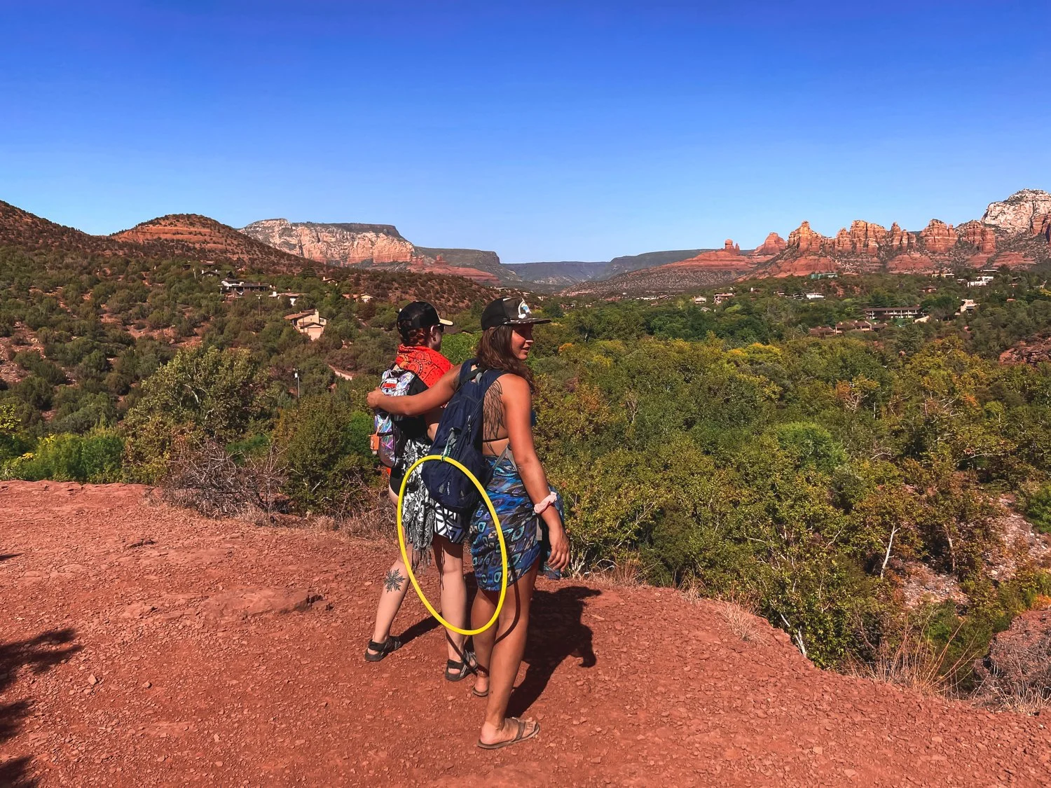
Although splashing, hula hooping, and hiking back up the rocky trail left us winded, we still left time to enjoy the green horizon views with a grin.

sedona caves trail

Rock: Drive to the Grand Canyon

Surprise! You’re driving to the Grand Canyon on night 3.

With Grand Canyon National Park residing a mere two hours away, we included a day to hike the famous world wonder.

The drive took less than 2 hours. We stayed at Grand Canyon Inn & Motel in Grand Canyon Junction so that we would wake up just 20 minutes from the national park. It was a safe, clean and most affordable option in the area.

Bonus: Day 4

Rock: Hike the Grand Canyon

If you have time to swing it, Sedona’s close proximity to the Grand Canyon makes the trip well worth the visit, even for folks like myself who have been several times before.

The Grand Canyon’s enormous route of trails tempts me to visit again and again (preferably not in the summer months, however).

We scuttled down the South Kaibab trail, taking one mile to reach Ooh Aah Point, one mile more to Cedar Ridge, and one mile to Skeleton Point, where unprepared hikers keel over from the treacherous altitude.

Obviously, going three miles down is always easier than stomping the three miles back up a furnace (I mean, canyon), so definitely be wary of your start time.

* * *

Conclusion: Sedona 3 day itinerary for the spirit

Sad but satisfied, that marks the end of the perfect Sedona 3 day itinerary in red rock country, plus a bonus day at the mother of all canyons.

As far as the spiritual energy, I concluded that I don’t need to visit a vortex to feel the ecstasy that excites my soul when camping and hiking. It powers my bones alone.

Stay safe, cool, and hydrated, and enjoy your spiritual travel.


hi wolfette, i’m molly

Travel is a spiritual experience for me, especially when adventuring solo.

After visiting 6 continents on my own, I’ve dedicated this project to assisting other Lone Wolfettes on their journeys.

I hope my travel guides help you find the same joy, connection, and empowerment that exploring our planet has given me.


related articles

Things to do in Southern Utah: 6 Epic Parks Besides Zion

Stand on the edge of the Earth, peering down at the crusted layers of core that peel back to reveal a deep canyon of rivers, trees, and multi-colored rock.

Ascend onto deformed shapes resembling goblins, castles, or backbones of a lurking beast.

Question your galactic surroundings as you squeeze through narrow slots of Mars-like walls.

* * *

Southern Utah is home to enormous stretches of natural treasures that make for a perfect road trip, all within a few hours driving distance of one another.

While droves of experienced trekkers swarm from around the world to hike Utah’s famous Zion National Park, this Southwest corner of the U.S. houses several other gorgeous Parks deserving of a visit.

If you are frequenting 3 or more national parks this year, you should purchase an annual national parks pass ($80) that gives you access to any national park in the country. For multiple state parks, Southern Utah maintains different passes, available upon arrival.

Following the route of our road trip, here are 6 epic national and state parks we conquered in Southern Utah:

Arches National Park

Arches National Park ended up being my favorite park, certainly worth the out-of-the-way excursion to the East side of Utah.

The famous Delicate Arch (featured in the article’s main photo) graces the Utah license plates for a reason. Each naturally-occurring arch in the park stands larger than life when you reach them up close.

Mellow, moderate, and difficult hikes reward visitors with hanging arches and glowing caverns.

We also witnessed petroglyphs throughout the park, finding them prevalent throughout Utah.

I recommend you linger in Arches after dusk, and even camp if you can. The animals meander at night, the people leave, but most of all, the starry experience lights up the silent magic of the park.

Dead Horse Point State Park

On the way to Canyonlands, we took an unexpected stop at Dead Horse Point State Park. The jolting name comes from the abrupt canyon drop-off where stampedes of horsed would unknowingly run over the side.

Thankfully, we didn’t fall down the canyon - but the panoramic views of the Colorado river astounded us.

The level walks around this small park brought relief from the daring adventures at the other parks, but still got us a bit lost, which is always fun.

Canyonlands National Park

Canyonlands’ name sounded like a theme park to me - and ultimately, the great heights, treacherous climbs, and hundreds of miles of trails fostered a similar happy-go-lucky experience.

This gargantuan park spans over 330,000 acres of land, with so much to do that I could return again and again. The park is divided into 4 districts: Island in the Sky (most approachable and popular), the Needles (farther hikes for backpackers), the Maze (most remote and inaccessible), and the rivers Green and Colorado.

When you reach the spout at the top of Whale Rock, you have to take a photo, right?

While the stunning Mesa Arch was closed, we stomped up Whale Rock, as well as a full-sun saunter along Murphy Point Trail (note to self: pack a parasol per person next time. Phew!).

In addition to hiking, Canyonlands offers river rafting, jeep tours and other backcountry excursions. You could easily spend a week there exploring.

Goblin Valley State Park

We screeched to a halt as we passed the sign for Goblin Valley State Park, a name too enticing to pass by.

Mushroom-shaped hoodoos personify little goblins in this trippy valley as you head West through the bottom of the state.

Weather and the elements carved these figures into thick monsters, causing you to wonder if you are on a bad psychedelic trip. You can spend time trying to guess what the hoodoos resemble, as if you were pondering over clouds in the sky.

Be warned, the dry heat lingers warmer down in the valley, where there are no set hiking trails - just wander freely. In late June, we couldn’t stay longer than an hour in the valley while we sweltered, even with full bottles of water.

Pleasantly, we completed the hikes around the valley that highlighted Molly’s Castle (hey, that’s me!) and a surprisingly skinny slot canyon.

Grand Staircase-Escalante National Monument

Encompassing over a million acres, we barely scratched the surface at Grand Staircase-Escalante National Monument. The staircase name details the row of plateaus from Bryce Canyon toward the Grand Canyon.

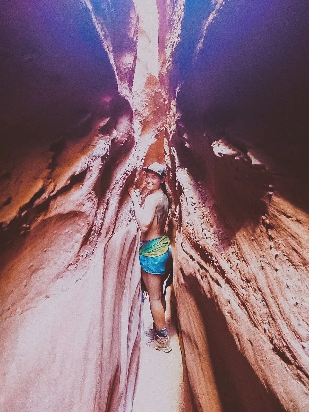
These photos featured are from the Spooky Slot Canyon, a hike so narrow that only smaller folks can squeeze through, without a backpack.

I learned rapidly that Utah hikes were not for the faint of heart, with parts of the hike you could seriously get stuck in (but yes, I still recommend it the challenge!).

The humongous swath of land in Escalante features waterfalls, gulches, slot canyons, and hundreds of miles of towering cliffs. In other words, the remote hiker can really get away from it all at the Grand Staircase, an epic place that deserves much more of my coverage.

Bryce Canyon National Park

Bryce was so nice, I had to visit it twice! Check out my article on how to spend 1 day in Bryce Canyon for a full synopsis.

The main access road through Bryce Canyon National Park stretches just 18 miles, packing the most punch into a relatively “smaller” park, so you can see a lot of variation in a short amount of time.

Connect Queens Garden with Navajo Loop for a fantastic well-rounded hike that features redwoods, peek-a-boo windows, lavish structures, and a rainbow of whites, oranges, yellows and reds.

The colors of Bryce pop as bright as the pictures, and sunsets shine absolutely golden.

Happy travels!

Gallery

How to Spend One Day in Bryce Canyon, Utah

Rustic red beauty, gargantuan rock formations, and mysterious valleys can keep you trekking through the elusive Bryce Canyon for days.

However, unlike other national parks, this Southern Utah park is fairly compact and is accessible for travelers who only have a day to pass through, often before or after the neighboring Zion National Park. 

bryce canyon

We were able to take advantage of the nearly 9 PM sunset time in June and discovered the best way to spend one day in Bryce Canyon National Park in the Spring / Summer season.  The views were stunning, colors struck a vibrant chord, and the golden hour saturated the skin and sky.

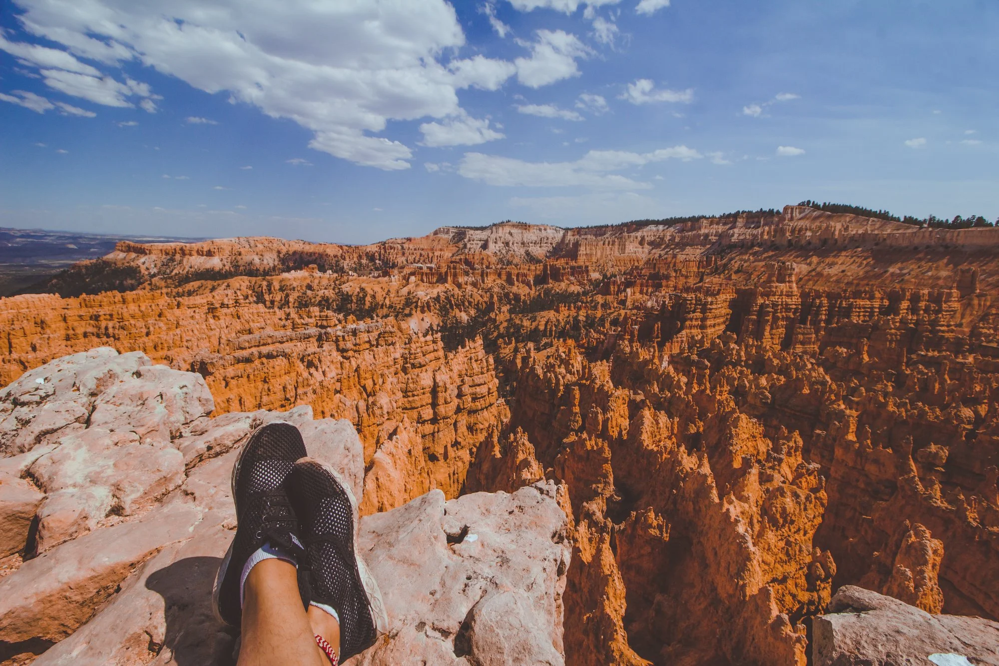
feet propped up along bryce canyon view

This spontaneous pit stop proved well worth the sunny day visit, though I will have to return again sometime in winter to experience the mystic icicles and snow-topped hoodoos, the eroded rock pillars that Bryce is famously abundant for.

Enjoy my guide on how to spend one day in Bryce Canyon National Park… and you don’t have to wake up at 6 AM to do it.  We’re living life on mountain time now, baby!

Morning

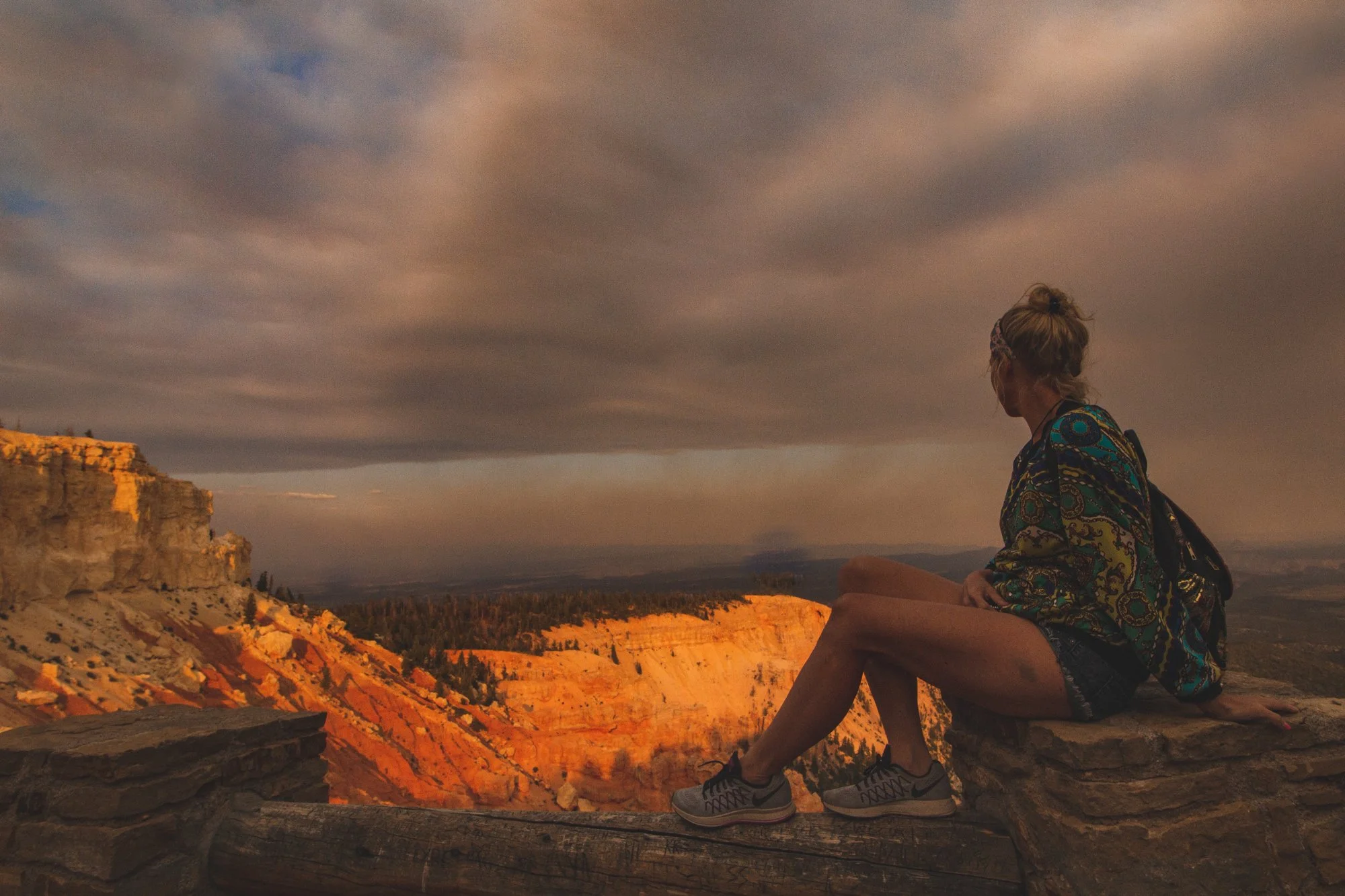
girl sitting facing bryce canyon

Gaze from the perimeter of Bryce Amphitheater: Sunset to Sunrise Point.

Immediately upon entering the park, you are greeted by Bryce Amphitheater, the orchestral valley with red, orange, and yellow hoodoos stretching as far as the eye can see. 

Jump out and stroll along the Sunset to Sunrise trail for one mile of epic photo opportunities along the entire perimeter. 

rock formation during sunset at bryce canyon

Descend down into the Queen’s Garden / Navajo Loop for up-close encounters of Thor’s Hammer, Queen Victoria, and Wall Street formations.

Potentially the most popular trail in Bryce Canyon, this 2.9-mile combination loop welcomes visitors embarking from Sunset Point to witness surreal changes in the earth’s landscape with striking caverns and monstrous structures that possess these distinctive names.

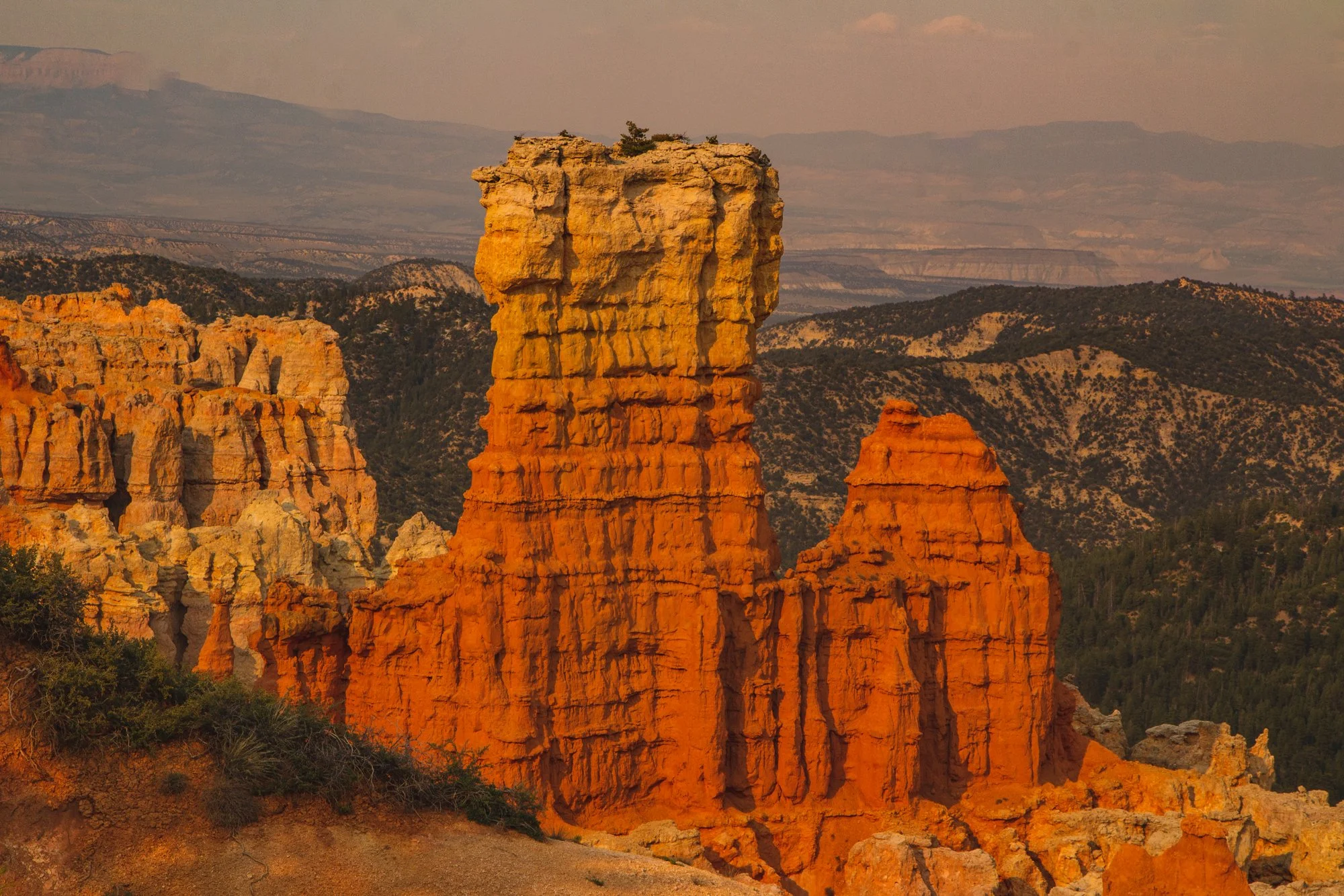
protruding rock tower in bryce canyon

Look for identifying hoodoos and wildlife as you continue along the scenic main road.

Highway 63 spans 18 miles of stunning viewpoints, the next being Inspiration Point and Bryce Point. 

Look for the arches and windows formed by hoodoos that categorize each landscape unique.

Wildlife roams freely through the park, with dozens of species of bird, mammals, reptiles and amphibians.  We spied mule deer, blue jays, ravens, lizards, squirrels and luckily, no Great Basin Rattlesnakes.  If you are fortunate, you could even encounter porcupines, foxes, or even the endangered California Condor.

me standing with dog at view

Afternoon

Switch up the scenery with an abridged visit to green Sheep Creek / Swamp Canyon.

While this hike through the quiet backcountry is 4 miles, you can briefly cruise through the tree-lined trail for as long as you desire before turning around, to steal a taste of the terrain.

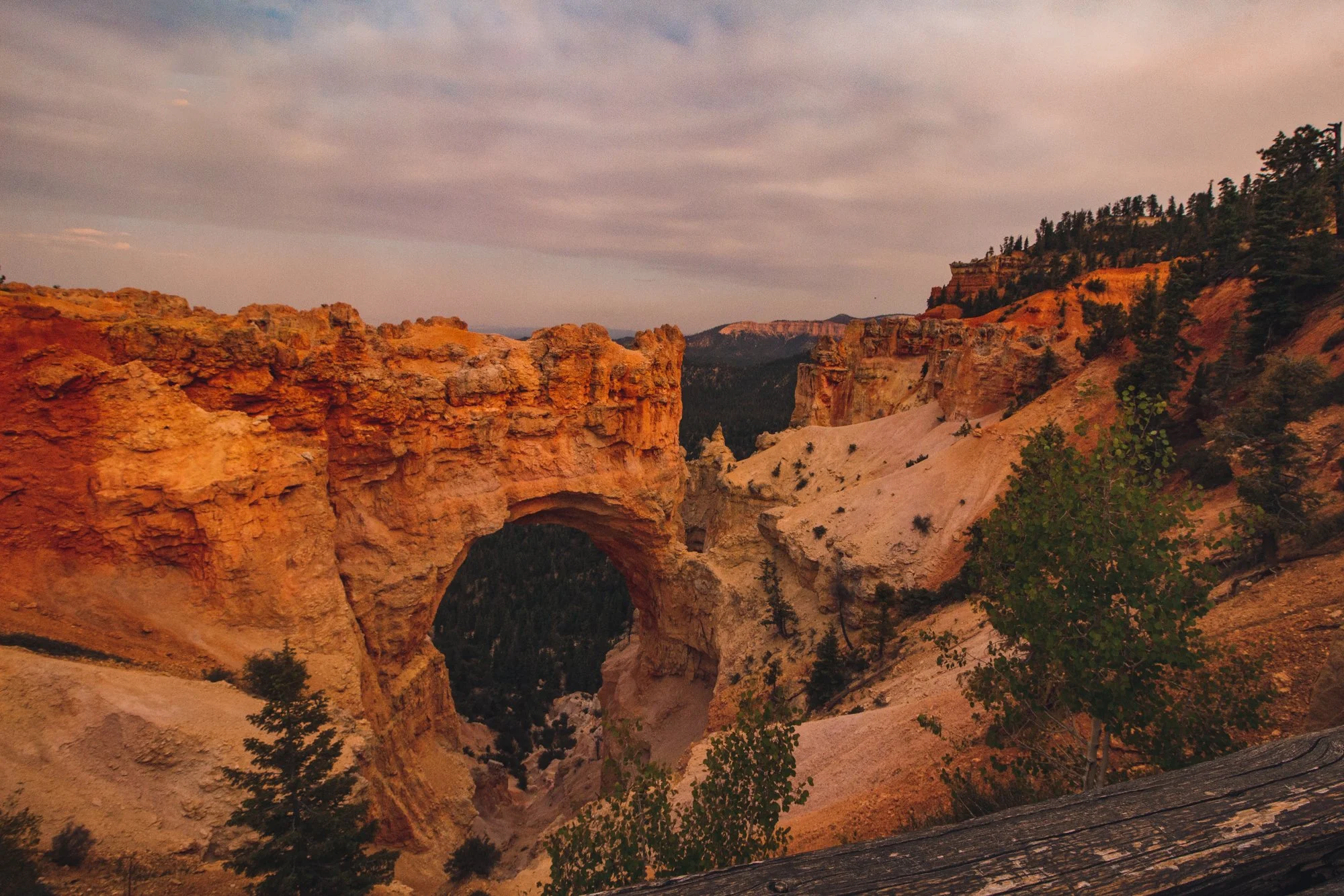
natural bridge bryce canyon

Relax at Natural Bridge and Agua Canyon.

Natural Bridge became my favorite viewpoint of the entire day and features the attention-grabbing arch that steers your eyes into the valley.  Agua Canyon is just a half mile down the road and full of imagery reminiscent of Dr. Seuss’ timeless book, Oh, the Places You’ll Go!…

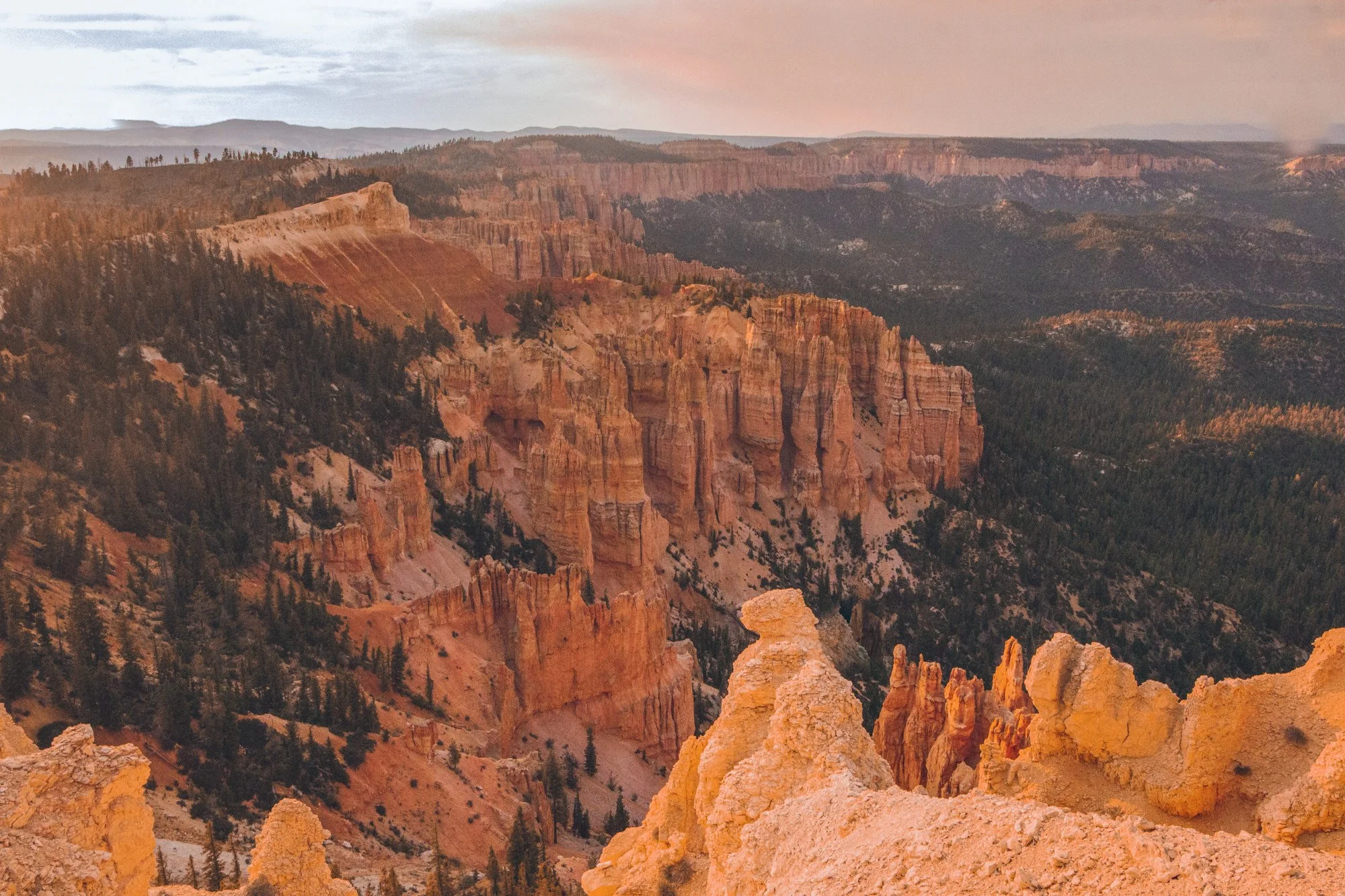
rainbow point bryce canyon

Travel down to Rainbow Point, the highest elevation point in the park at over 9000 feet, and meander around the Bristlecone Loop Trail. 

Rainbow Point earns its name from the myriad of colors emitted from its topography: dark green trees mixed with whites, reds, and orange natural amphitheaters. 

Our jaws dropped at the panoramic view before we moseyed through the 0.8 mile Bristlecone Loop, a partially shaded walk decorated with fir forests and bristlecone pines, like a winter wonder dream in the Summer.

Hiking trails bryce canyon

Offer a final farewell at Yovimpa Point, around the corner from Rainbow Point.

End your excursion at Yovimpa Point, where the Grand Staircase peeks at you from underneath layers of rock.  The Pink Cliffs, Grey Cliffs, and White Cliffs would make this point a more fitting name than Rainbow Point.

* * *

hi wolfette, i’m molly

Travel is a spiritual experience for me, especially when adventuring solo.

After visiting 6 continents on my own, I’ve dedicated this project to assisting other Lone Wolfettes on their journeys.

I hope my travel guides help you find the same joy, connection, and empowerment as exploring our planet has given me.


Related Articles